San Gorgonio

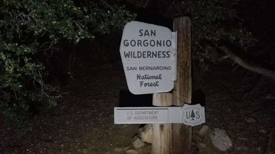
Peak Name: Mt. San Gorgonio
Distance: 19.5 miles
Date: September 1, 2019
Summit: 11,503 feet

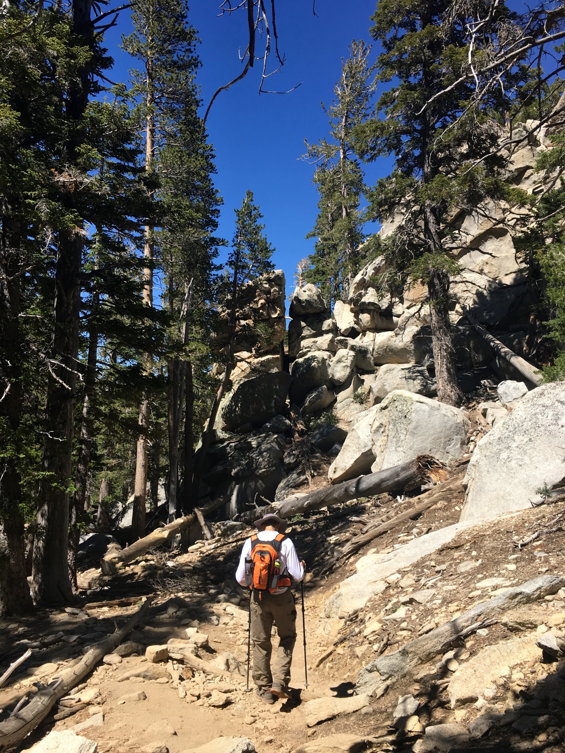
San Gorgonio, “Old Greyback”, the highest peak in Southern California at 11,503 feet. That was our goal for the day. Ted Markus and I reached the Vivian Creek trailhead at 4 am. Donning our headlamps, we set off along the service road next to Mill Creek. After about a half-mile, we crossed the dry creek and onto the trail. The next mile or so was a steep climb. Thankfully in the darkness, we could only see right in front of us. Later during our return, we realized the steepness of the section. I had read the trail guides, and they weren’t kidding.

20190901_045441

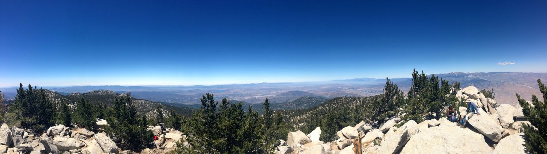
The trail followed Vivian Creek for a spell. So far we were both feeling good. The sun began to finally rise over the mountains, revealing the beauty of the area. A warm glow shone on Mt. Baldy to the west. We encountered a few other hikers along the trail.

As we approached the switchbacks, the elevation was starting to get to me some, but we kept pushing upward. After about 7 miles and at 10,000 feet, I was really starting to question if I could summit. With Ted’s encouragement, I continued on.

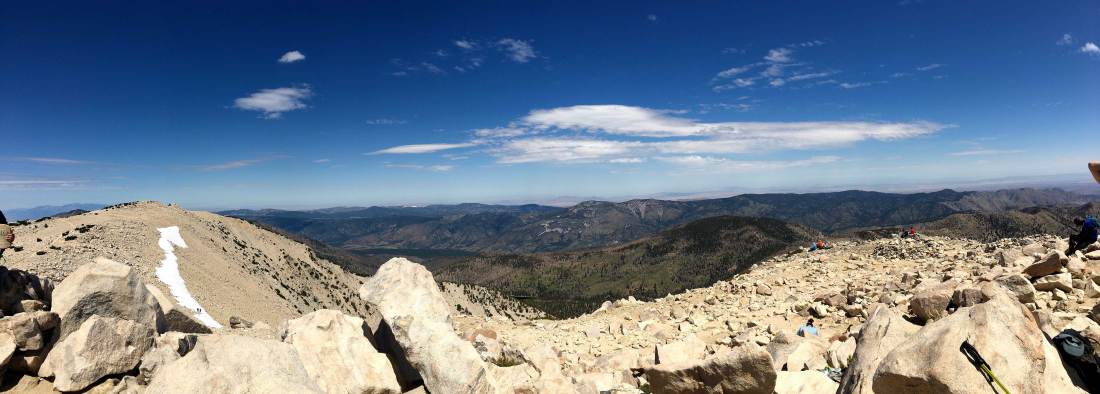
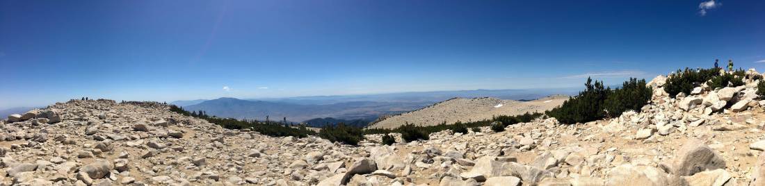
Once we broke the tree line, I found my second wind. Also, the summit was also in view. The traverse went fairly smooth and soon we were atop San Gorgonio!!

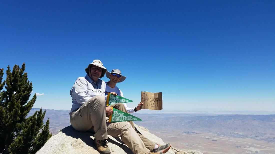
Unlike San Jacinto, the summit sign was still there. Ted and I recreated “Bill and Ted’s Excellent Adventure“ pose since we had just completed the A16 3 Peak Challenge!! I would say about 40 or so others were also there on the summit, include several other 3-Peakers. In fact, there was one hiker who was attempting the 1-day version of the challenge!

IMG_5383-1
Looking northward
IMG_5391-1
Looking south, San Jacinto stand across the divide
IMG_5384-1
Looking southwest

After a break and photos, we began our descent. A sense of accomplishment filled me as we began our 9.5 miles back to the car. I knew the summit took a bit longer than planned, but I did it! Now the question was, will Ted hurt himself on the descent? On Mt. Baldy he hurt his wrist. On San Jacinto, he twisted his ankle. Sure enough, he slightly twisted his ankle again. Not as bad as last time, but enough. That was ok, as my knee began to ache. We kept cruising carefully down the mountain. The day was warming up, but we had plenty of fluids. I did opt to filter some water at the first crossing of Vivian Creek, in part since it was nice and cool. It also served as a nice break to let my knee and feet have a rest.

A Search and Rescue helicopter flew overhead. We were unable to understand what they were broadcasting. It appears the heat did get to someone. We never found out what actually happened.

Soon, we were closing in on the end of the journey, and we slowly made our way down that steep section. Back at the car, we peeled off our boots and changed in something less disgusting. We swung by the University of Redlands to drop off a few things for my daughter. Then some food and nice flight from Hanger24 before the drive home. Now back to the 100 Peak Challenge!

Mount San Jacinto (via the tram)

Peak Name: Mt. San Jacinto
Distance: 10.5 miles
Date: July 14, 2019
Summit: 10,863 feet

So we set out to summit San Jacinto today for our second peak of the A16’s 3-Peak Challenge. We opted to take the ‘easier’ route from the Palm Springs tram station to the summit. The first tram up was at 8 am and was completely full of hikers ready to hit the various trails.

After the short ride to the upper tram station, we headed down the cement switchbacks to the Ranger Station to get our permits. From there we began the 5 or so miles and just about 3,000 feet of elevation gain toward the summit. It was nice hiking under pines trees and along a running creek, something that is a rarity in San Diego. The trail is very well marked, so no issues with navigation. Just past Round Valley, we started to get a glimpse of the summit.

Ted and I kept pushing higher and higher toward the summit, first toward Wellman’s Divide. After a short break there and some nice views, we set out again. The trail began climbing across the east flank of Jean Peak, pausing briefly at a flat cleft at 10,000 feet before continuing north on the east side of San Jacinto. There are few trees along this section, so remember your sun protection. We had to keep reminding ourselves that we were hiking a bit higher than the mountains of San Diego as we made our way up. At the junction with the Marion Mountain trail (my route the first time), we grabbed another quick break in the shade, since there almost none at the summit.

Soon the rescue hut came into view and the final boulder scramble to the summit. Several other 3-Peak challengers soon joined us also. The views were incredible, but sadly the wooden sign was gone. San G loomed to the northwest, our final peak of the A16 3-Peak Challenge.

IMG_4387

IMG_4386

20190714_114743

After a snack and rest, we began working our way back down the mountain. Unfortunately, about a mile down the trail, Ted rolled his ankle. He was able to put weight on it and we carefully continued down. Those hiking poles paid off.

IMG_4412

We found ourselves back at the Ranger Station and returned our permit copies. Then came those concrete switchbacks back to the tram station. This might have been the toughest section of the whole hike 😉

IMG_4413.jpg

We grabbed a bite to eat and then took the tram back down to the desert floor. Thankfully, Ted just sprained his ankle and his wife will still let me have ‘play-dates’ with him 😉 Now, I am taking next weekend off and going to see historic spacecraft and celebrate the 50th anniversary of the first moon landing in Neil Armstrong’s home town!

Mt. Baldy (San Antonio)

Peak Name: Mt. Baldy
Distance: 10.5 miles
Date: June 23, 2019
Summit: 10,064 feet

What an incredible summit today! Ted Markus and I drove back up to Mt. Baldy for the Climb For Heroes Comeback Tour event. The weather had canceled the first attempt in May. This was to be about an 11-mile round trip hike with about 4,000 feet of elevation gain topping out at 10,064 feet.

Along the way, we meet and chatted with wounded vets, and watched them climb the summit as well. Our route took us across the Devil’s Backbone, so we had quite the traverse.

It was a tough one. The final push to the summit was hard and took a lot of mental energy to ascend the last mile.

The views were incredible and the entire crew supporting this event was awesome.

This peak was the first of our A16 3 Peak Challenge. Thanks to all the sponsors for this event including Eddie Bauer.