Los Pinos Lookout

Peak Name: Los Pinos Lookout
Distance: 0.5 miles
Date: November 24, 2017 (Sept 15, 2019)
Summit: 3,189 feet

When we were hiking out to Corte Madera, we considered also summiting the nearby Los Pinos Lookout Tower. But the route from the Espinosa trail followed a dirt road that had off-roaders using. Although there was a more direct route, it was a steep ascent, and we opted not to tackle it.

I debated how I wanted to return to summit this peak, as I am not a big fan of hiking on active roads. Instead, after summiting Long Valley Peak, I drove down to the Corral Canyon OHV area, passing the parking spot for the Espinosa trail. Continuing along the road, I kept driving until I approached the Four Corners trailhead. From there I made a right and continued up Los Pinos.

img_6375

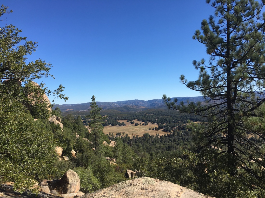
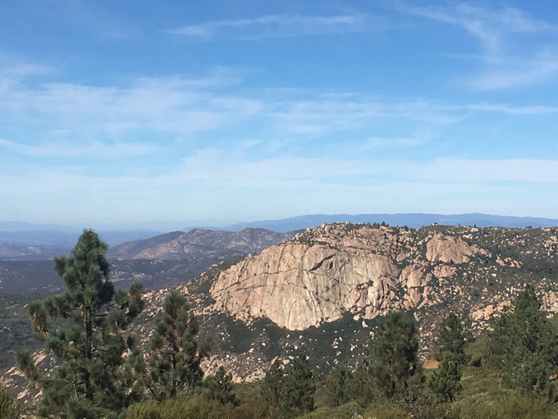
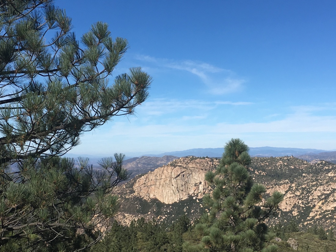
Near the summit, I found a nice place to park and hiked the .25 miles to the lookout tower and the summit. The tower is closed, so I wandered around the summit enjoying views.

Corte Madera’s sheer face is clearly visible in the distance.

img_6379

I returned to my car and drove back down, passing several other off-roaders along the way.

Update: September 15, 2019

While I had considered fully hiking up to Los Pinos from the Espinoza saddle when I restarted my 100 Peak Challenge, the temperatures were not favorable. So, instead, Ted and I drove up toward the summit and would hike the last bit to make it count.

After working our way up the semi-paved road, thankfully only encountering one motorcycle, we pull over at the turn off to the summit. We hiked up the road. The Los Pinos Lookout tower was manned, and we were invited up.

We got a full tour of the tower and how it works. He shared some of the wildlife he has captured on his camera. It was quite a collection of critters.

We bid farewell and took the shortcut back to the car. This quickly little jaunt was my 64th peak of the 100 Peak Challenge!

los-pinos

Corte Madera

Peak Name: Corte Madera
Distance: 6.9 miles
Date: September 24, 2017 (September 15, 2019)
Summit: 1,562 feet

Known as the Half Dome of San Diego, this was a fun hike with Dave and Ted in tow. Located in the Pine Mountain Wilderness, we found one of the few parking spots and began our hike along a dirt road under the shade of coast live oaks. Once we reached the Espinosa trail, we began to slowly climb up toward the saddle between Los Pinos Mountain and Corte Madera.

IMG_4988
Corte Madera Valley

Turning northward, we passed near the summit of Coulter Peak, working our way through the chaparral along a single-use trail. Eventually, the trail reaches the summit of Corte Madera.

IMG_4996
Looking southwest from the summit.

We took a nice break, enjoying some snacks and the view. Corte Madera’s dramatic south face plays host to a number of nesting birds of prey, including falcons, hawks, and golden eagles. These birds tend to nest during the late fall, winter, and early spring months. Cleveland National Forest has introduced seasonal closures along the mountain’s sheer cliff. We did not spot anything flying while we rested.

img_6387
Corte Madera from Los Pinos

Returning back to the saddle, we considered adding in the extra miles and elevation to Los Pinos Lookout. But, we were tired and decided to save it for another day.

Update: September 15, 2019

The sun had almost risen as we pulled into the turn out to the start of today’s hike to Corte Madera. We had done this hike almost two years before. This time we were just missing Dave.

IMG_5705

As we began following the road to the Espinosa trail, the oaks that lined the road would be providing welcomed shade upon our return. Once we made the turnoff, the trail began to climb, and after a bit, the oaks receded. The sun finally crested the distant mountains as we made our way up to the saddle.

Once there, a lone Subaru was parked. We wondered if we would run into them along the trail. Los Pinos stood over us to the south. From here we had our first glimpse of Corte Madera glowing in the early morning sun.

IMG_5715

After following the road north for a bit, we would again return to the trail. This is where we would gain a modest amount of elevation. The day was already beginning to warm, as we pushed upward. Once we spotted the split rock, we took a short break.

The trail would continue working its way westward. While the trail is easy to follow, you will want to wear long pants, as there is some overgrowth along with it.

Soon we reached the summit! We did not stay too long as we could feel the day getting warmer. There did not seem to be a benchmark, but we located the register near the edge of the cliff, secured to a bush.


We quickly made our way back down. The one rocky descent we had going out to the peak was almost trivial when ascending. Soon we found ourselves back at the saddle, and the car still there. Hum? The day was continuing to warm up as we headed down the Espinosa trail. Those oaks along the road did provide some welcomed shade as we made our way back to the car. This was peak #63 of my #100PeakChallenge!