Peak Name: Mount Gower
Distance: 7.51 miles
Date: December 24, 2018 (June 11, 2019)
Summit: 3,105 feet
Since my wife and daughter were driving up to LAX to pick up my son from his trip to Florida in the Subaru, I was somewhat limited to my peak options. Thankfully, Mt. Gower near Ramona fit the bill.
I opted to start the hike by using the water tank short cut. Parking at the culdesac, I tried to be respectful of the homeowners, as I readied myself. I headed up the access road to the water tank, then pass around the fencing to join the trail. For those wanting a longer hike, there is another trailhead near the end of Gunn Stage road.
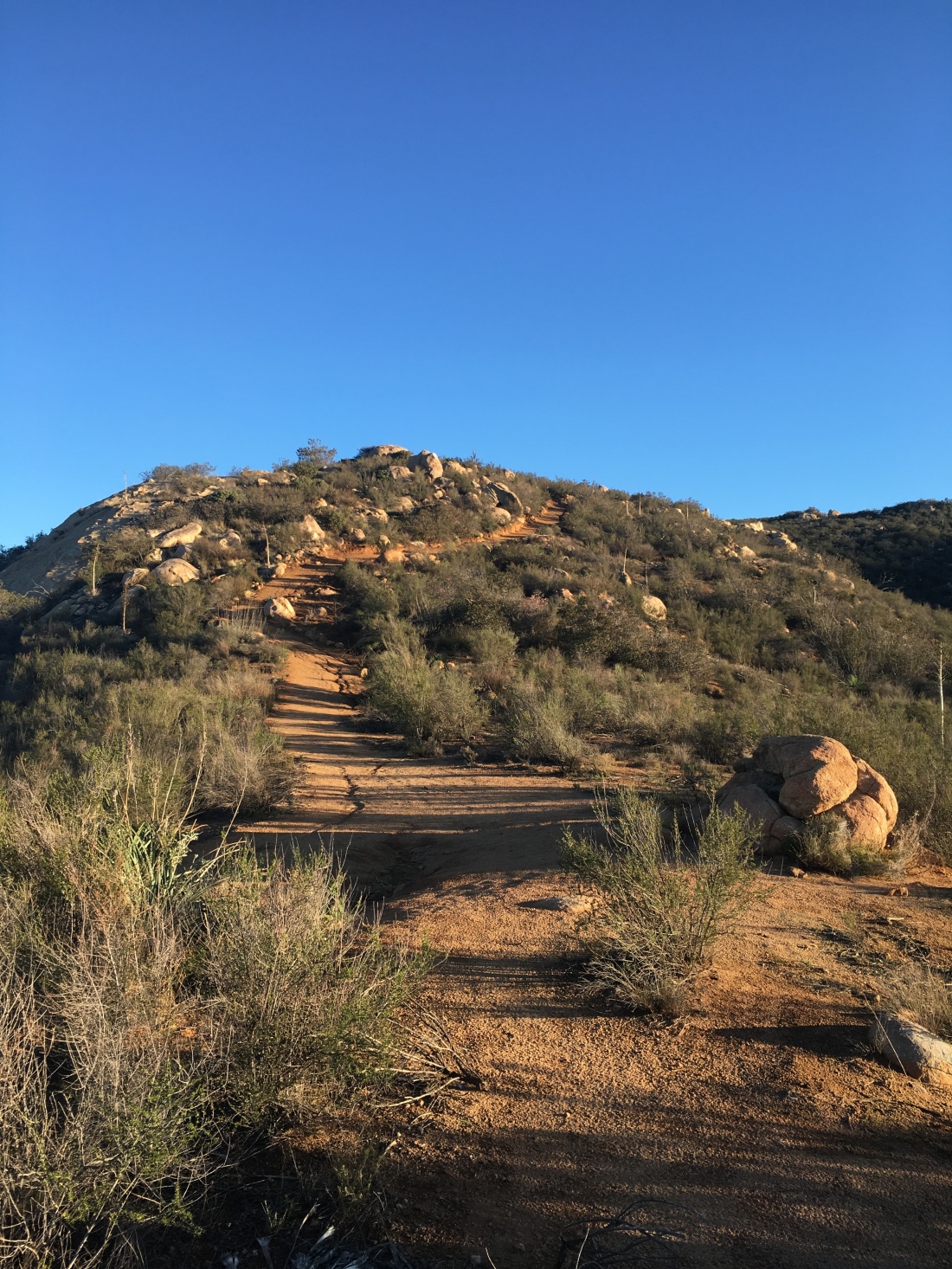
The trail will basically follow a ridgeline eastward, rising and following, but generally working its way up. After passing a small meadow, you will begin the push up the peak. Along the way, you will pass Mt Gower’s famous teeth.

A short time afterward you will reach a wide flat granite slab. This is where the defined trail will end. I took a moment to enjoy the view. A pair of hikers were working their way back to the trailhead, we briefly chatted and continued on our way.
Following Scott Turners’ advice, I checked my GPX route and began working my way up the slope. It was a mix of digital routing matching and experience to reach the top.
Mt. Gower is an interesting peak. There are actually three peaklets here. False Gower is the first peaklet that you will encounter, and for most this is good enough, even for the 100 Peak Challenge.

There was a bit of breeze at the summit, as a storm was due in later that night, so I did not linger.


I decided to work my way through the brush southward to the true summit. My phone weighed out, so no route data, and no photos. It took a bit to make it there. Like the reports on peakbagger.com, no benchmark or register was located.
Checking with the family, to hear my son landed safely after being delayed from the previous day, I began heading back down. As I drew closer to my starting point, I encountered a few more hikers beginning their ascent of Mt Gower. Back at the car, I loaded up and headed home.
Update: June 11, 2009
With my sister and her family arriving later in the afternoon, I decided to get a peak in before they landed. Derek had mentioned he would like to do another training hike up Mt. Gower, and I needed to summit it again. My last summit was on Dec 24, 2018, so just on the wrong side of the calendar. Unfortunately, the first heatwave of the season hit San Diego. The initial forecast was to be in the 90s. We figured with a sunrise start we should be ok.


We drove out to the end of Gunn Stage Road and parked next to the locked gate. A use trail led us over a small rise and onto the main trail in front of ‘TeePee’ rock. From there we began working our way along the trail. It is always nice to hike with a friend, conversations can certainly make the miles tick away faster.

Passing a lush green meadow, we soon began the push up the mountain. The small bumps we crossed over would not be fun on the way back. Think of it as a mini El Cajon mountain hike.


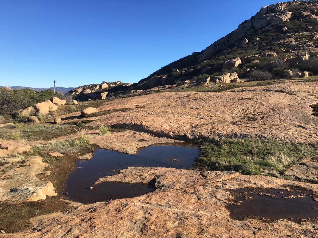
We passed by the Gower Teeth and soon found ourselves on the granite slabs that surround Mt Gower. While most people will continue upward toward False Gower, we followed the use trail that took us southward. Derek would check his route as we worked our way toward the true summit which sits at the south end of the peak.


Some water was still flowing in some spots making it a tad slick in a few spots. We weaved our way across an open space until we found the route again. Soon rock cairns and Derek’s route had us back on the trail. Soon the true summit came into view. We sat and enjoyed the view and signed the register. The heat was rising so, we knew we needed to start back down.


We began retracing our steps back down. As we crossed back past Gower’s Gate, the heat was starting to take its toll. I began conserving energy as we headed back.

Both Derek and I were completely shocked as we encountered another hiker heading up. Not only were we questioning going up in this heat, but he had no hat or sunglasses. Oh well. I later saw another check-in on peakbagger.com and it turns out this hiker has been bagging peaks left and right.

The heat continued to build and I was starting to suffer. I took a nice break in the little shade I could find. Derek kept pushing forward and I kept my pace at what I could handle.

Once I reached the turnoff to the water tank, I texted Derek I was going to bail here and wait for him to reach the car and drive back and pick me up. I just did not have the energy to descend into the canyon then back up again.

This was the same starting point I used the first time, so I knew what I was doing. As I walked down the asphalt road, the telltale sounds of a rattlesnake filled the air. Since I was in the middle of the road, I kept on walking. I reached the culdesac and found some shade to wait under. I finally broke down a looked at the action temperature, 100F! Yikes! That was a bit more than we planned for and explains why I faded so badly. Derek made it back to the car after a small route-finding error and a shade break as well. Soon he arrived and I climbed into the air-conditioned car. We were both amazed at how hot it got! We agreed that if we knew that it was going to be that hot, we would have found something else to have hiked. But we also realized we both knew what we needed to do to push through the heat.
But I can proudly say that Mt. Gower is now summited for my 100 Peak Challenge! #38!

