Oakzanita Peak

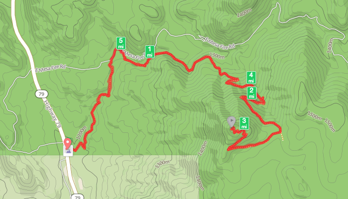
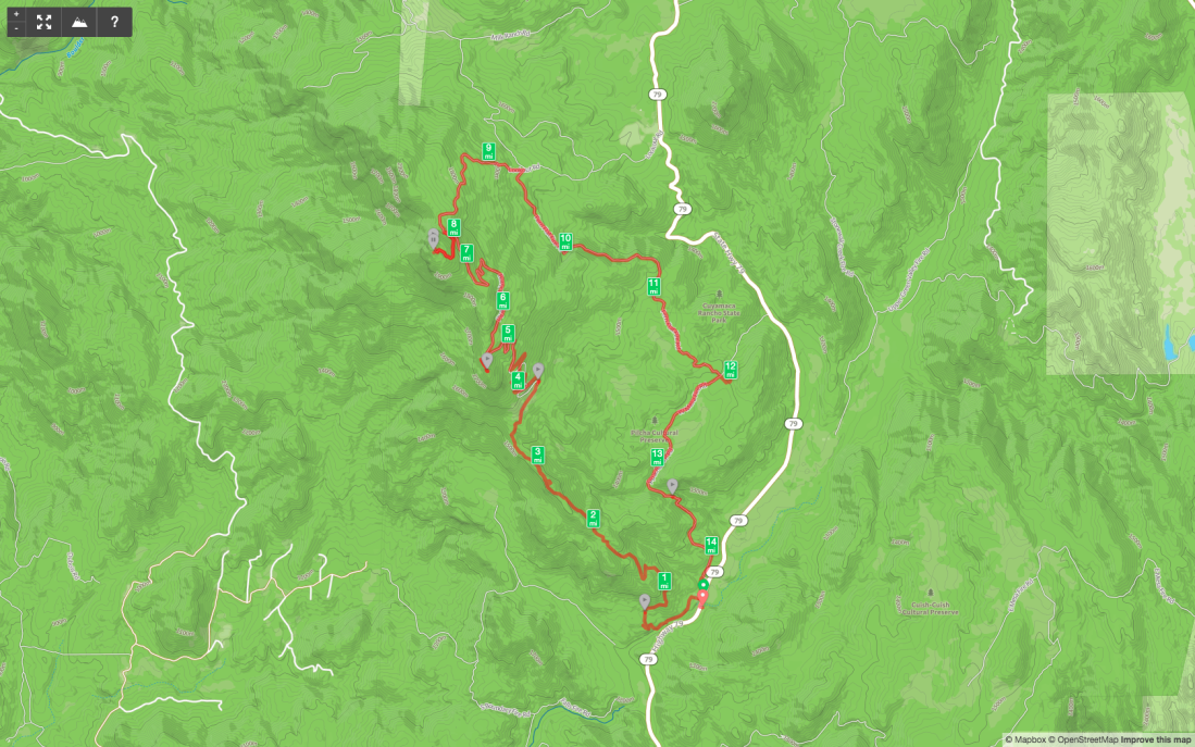
Peak Name: Oakzanita Peak
Distance: 5.9 miles
Date: July 2, 2017 (Sept 14, 2019)
Summit: 5,054 feet

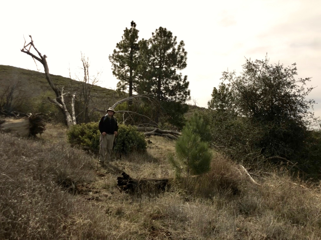
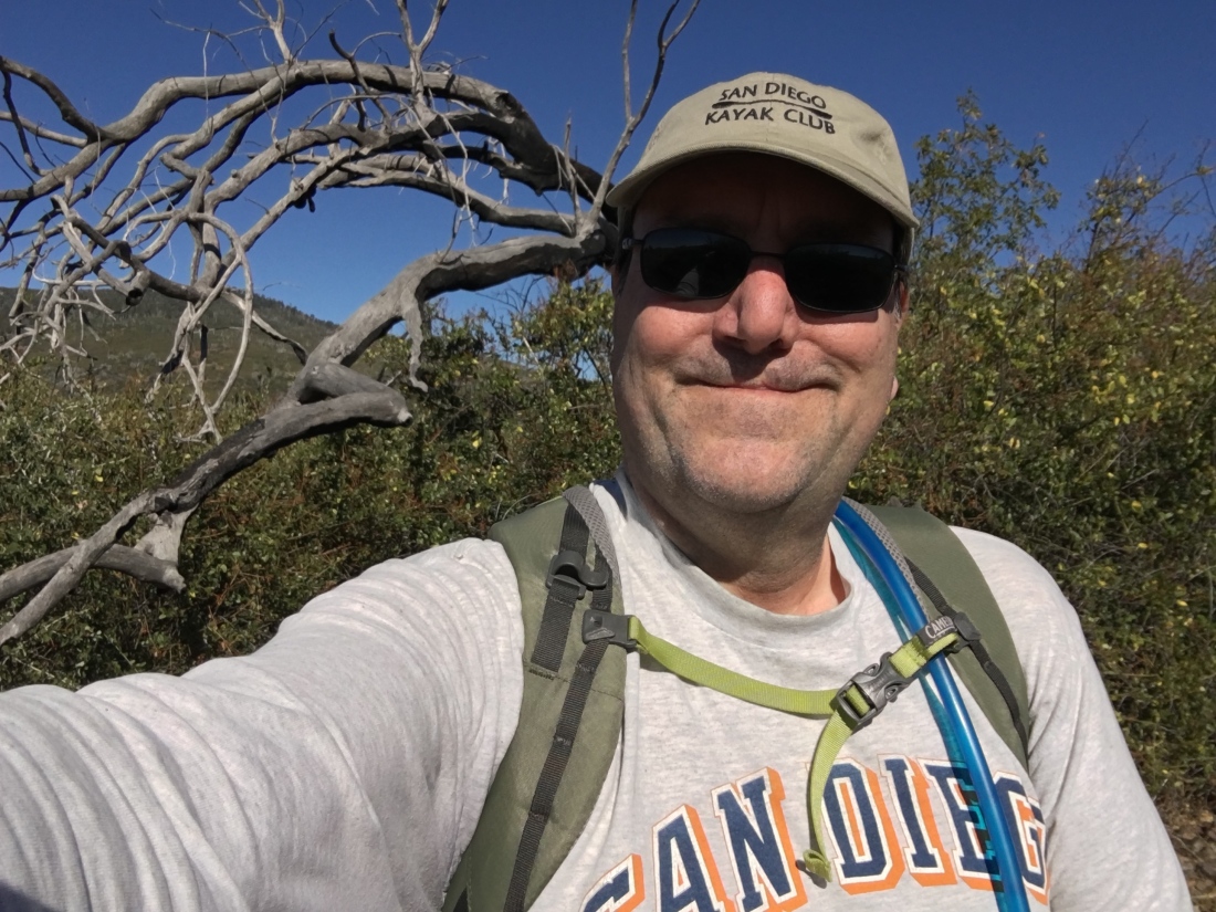
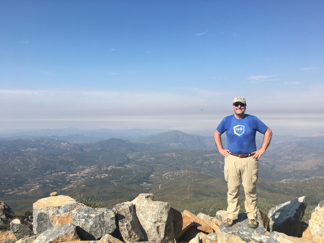
A perfect way to kick off the Fourth of July weekend! I convinced my friend Dave to tag along for this one. Unlike when Derek summited this peak, there was not a lick of snow to be had ;).

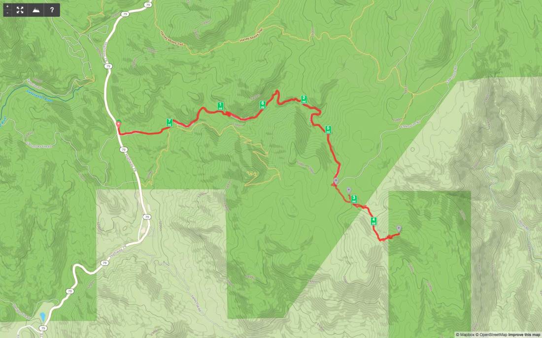
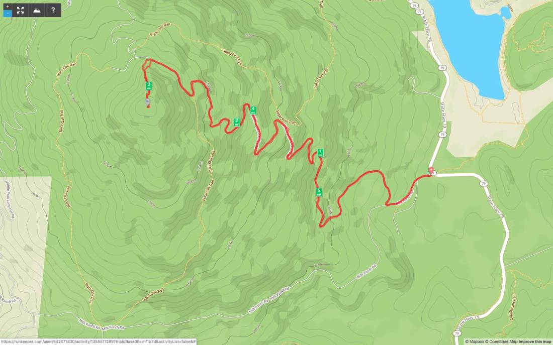
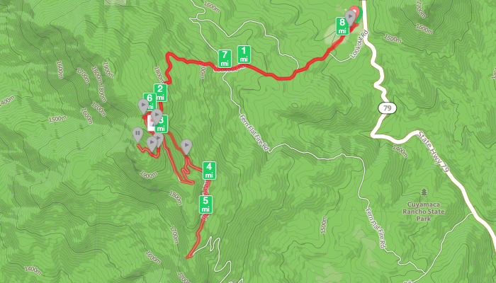
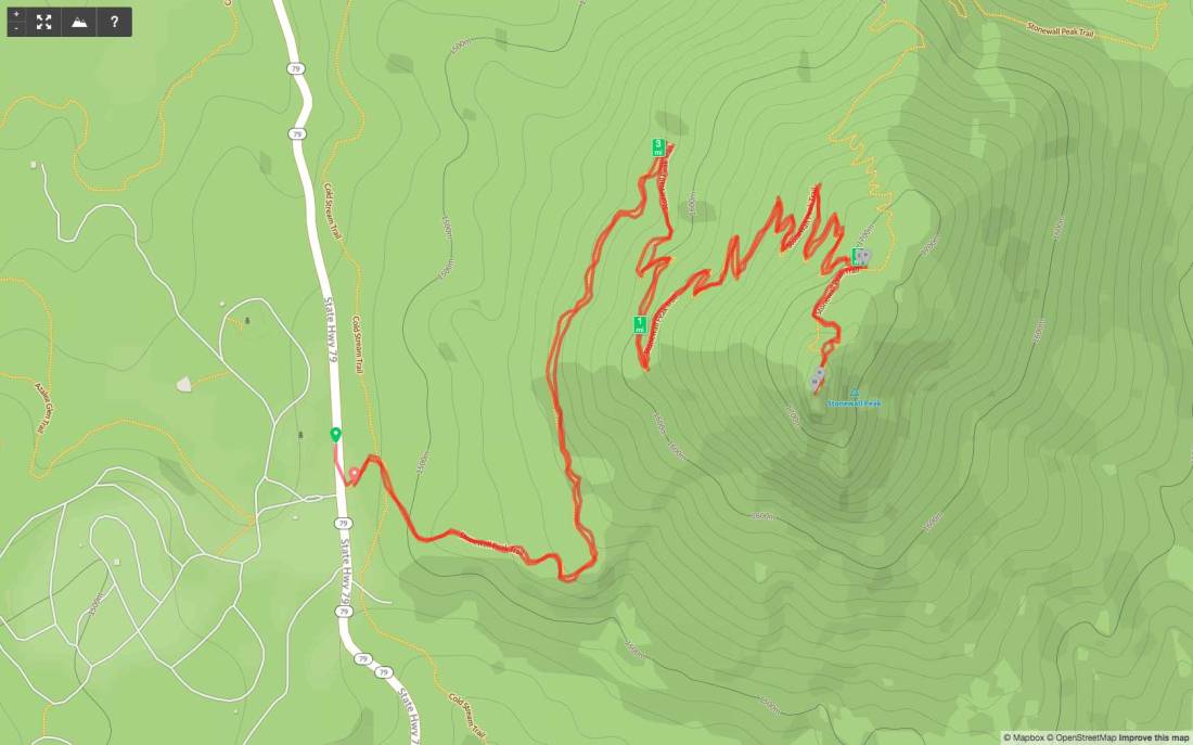
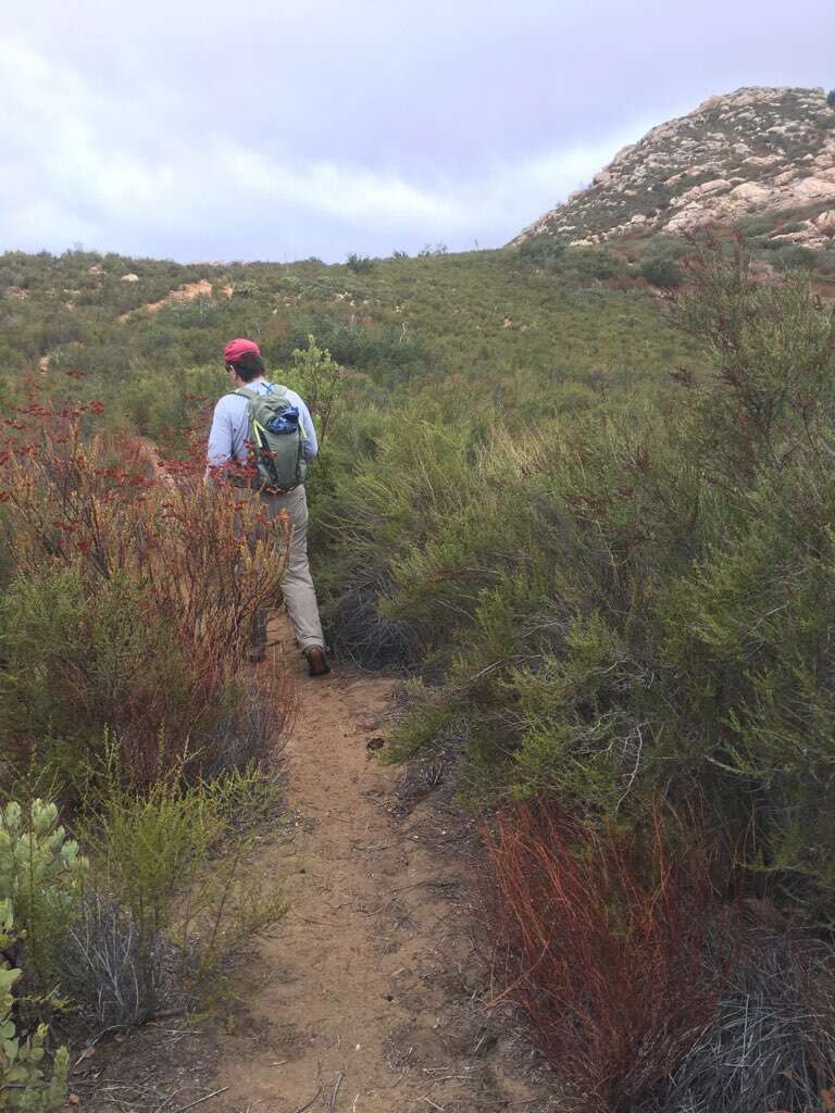
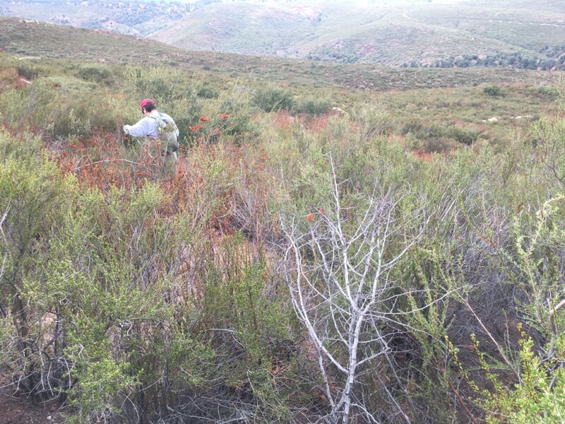
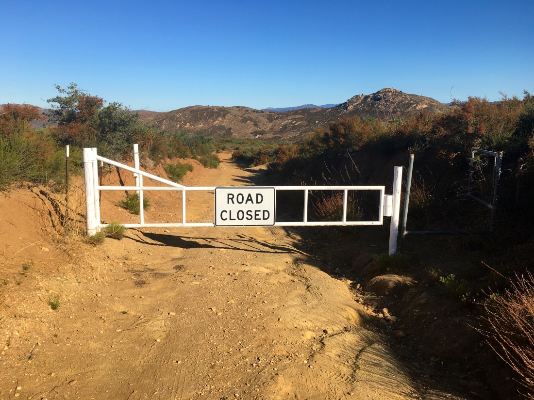
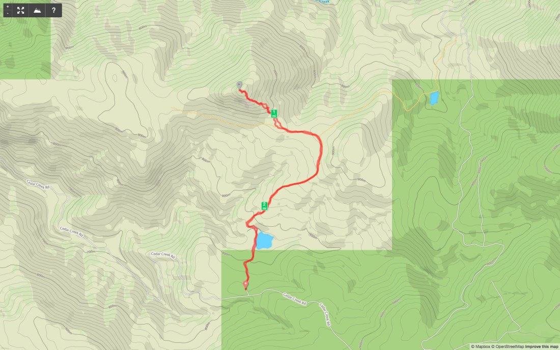
The trail works its way northward for a bit before turning east at the East Mesa Fire Road. You are on the road just for a short bit before veering off. The trail wraps around Oakzinta peak and approached from the south and east.

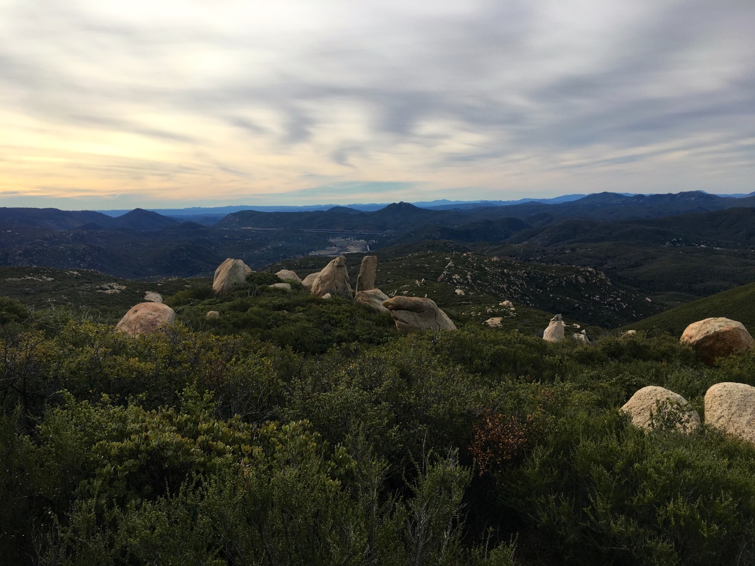
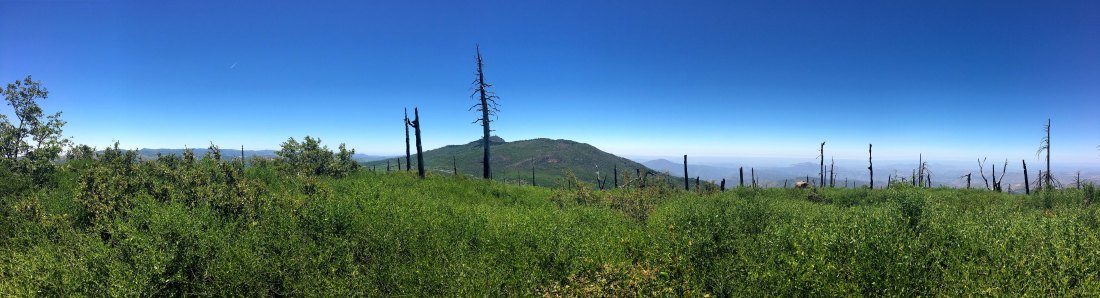
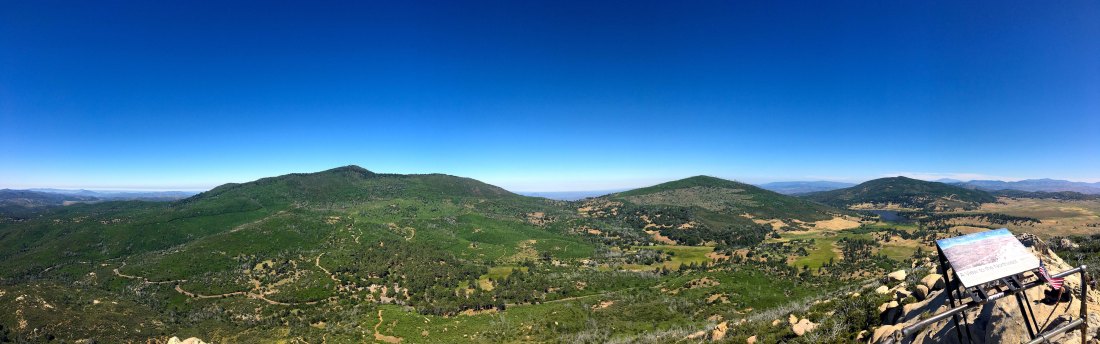
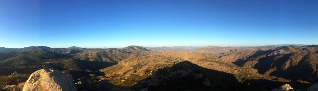
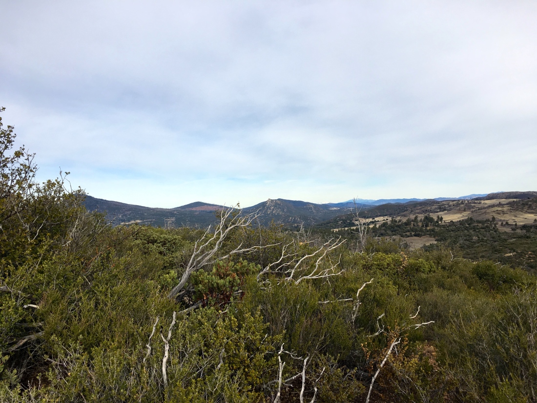
The views from the summit we lovely, except we did have some flying ants bothering us, so we did not stay too long.

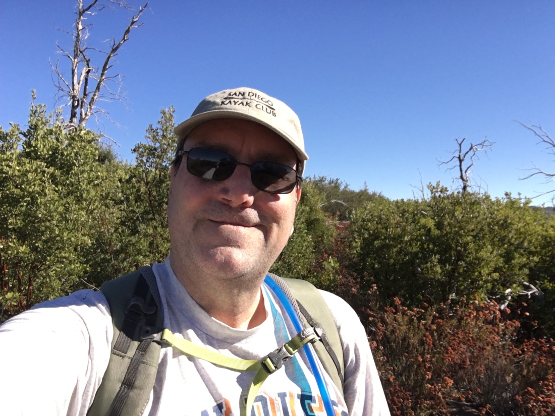
Update: September 14, 2019

The late-season heatwave certainly altered my planned hike for this Saturday. I had hoped to take a friend out and summit Lawson and Gaskill. But with the forecast in the low 90s, almost no shade on the trail and rocks that will get quite toasty, this hike was not in the cards. Looking over my remaining peaks and Oakzantia seemed to a safe replacement.

IMG_5623

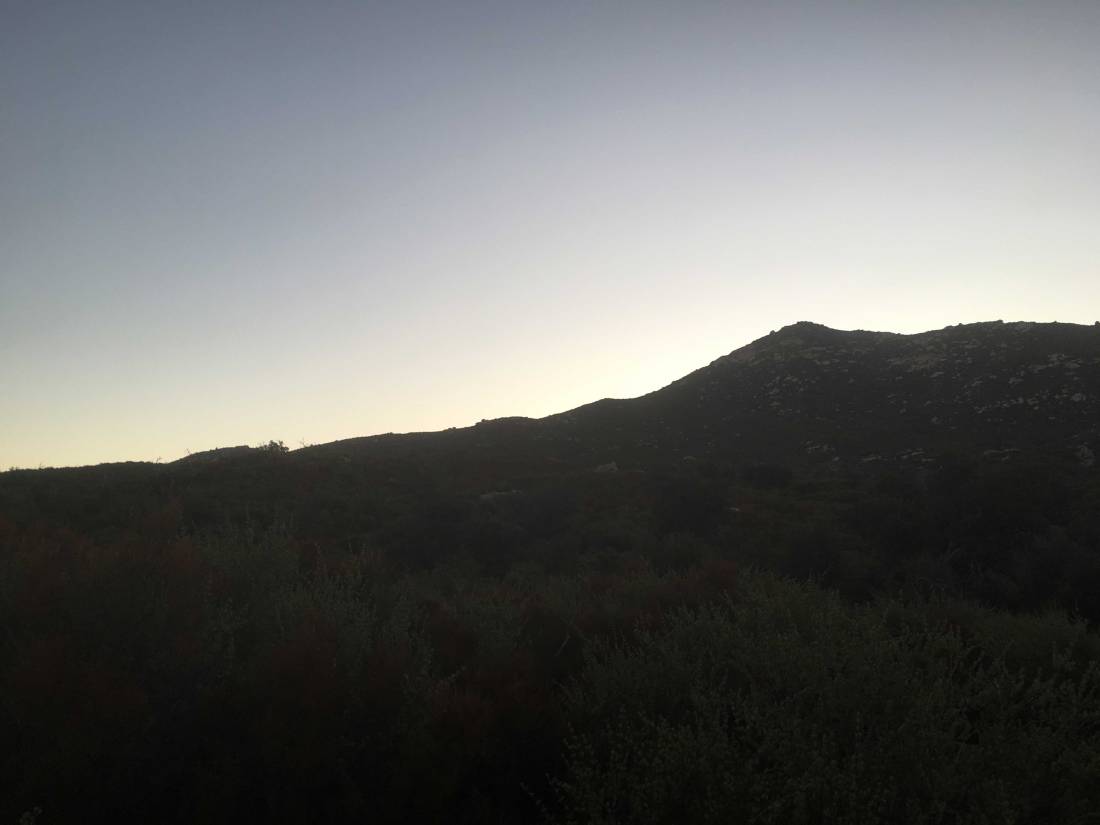
I got to the trailhead at sunrise. I debated if I should use the East Mesa Fire Road or the Oakzantia trailhead. Since I did the Oakzantia trailhead last time, I opted for it so I could compare my pace. The air was still cool as I followed the Lower Descanso Creek trail. A little water still flowed in a few spots along the trail.

IMG_5629

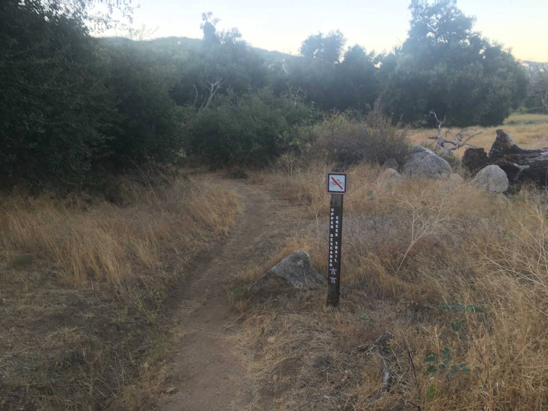
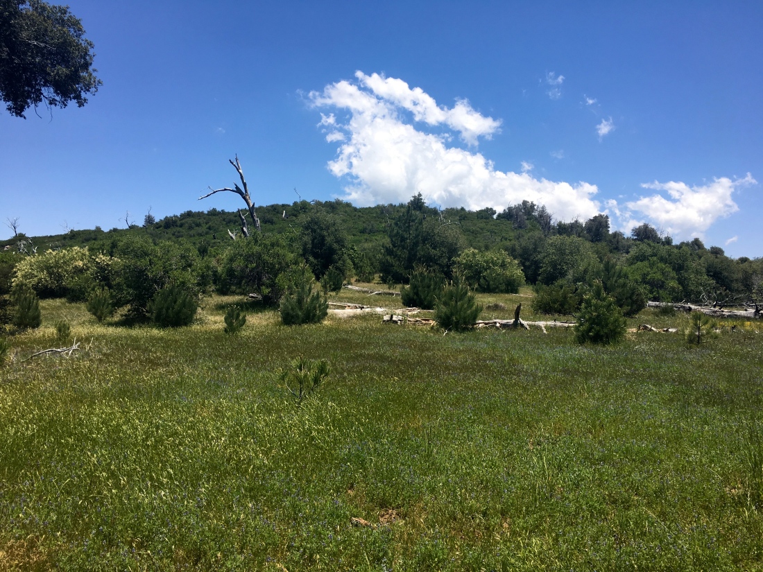
This trail rejoins the East Mesa Fire Road for a short time, hence why I considered the other route. Once you have rounded the meadow, I headed on the Upper Descanso Creek Trail. Crossing back to the south side of the creek, it was now time to begin working my way to the summit. I still enjoyed the shade, but the sun was starting to illuminate Cuyamaca’s peak to the north.


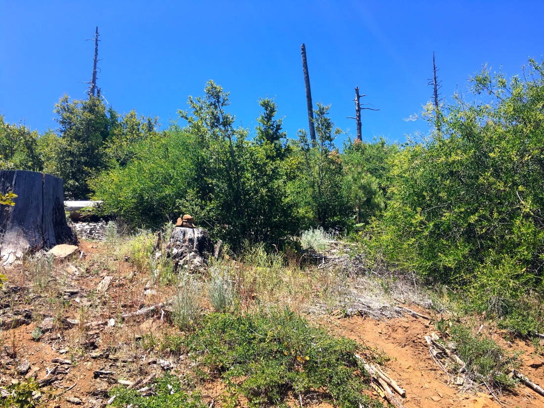
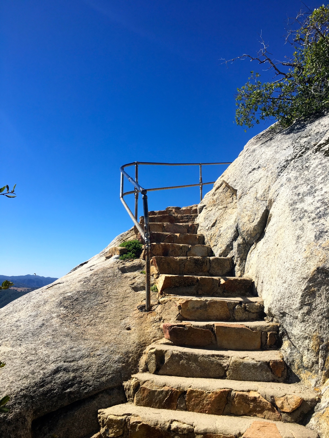
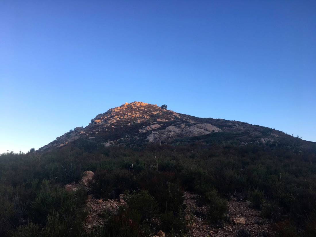
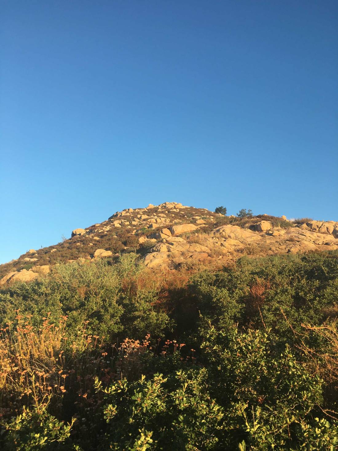
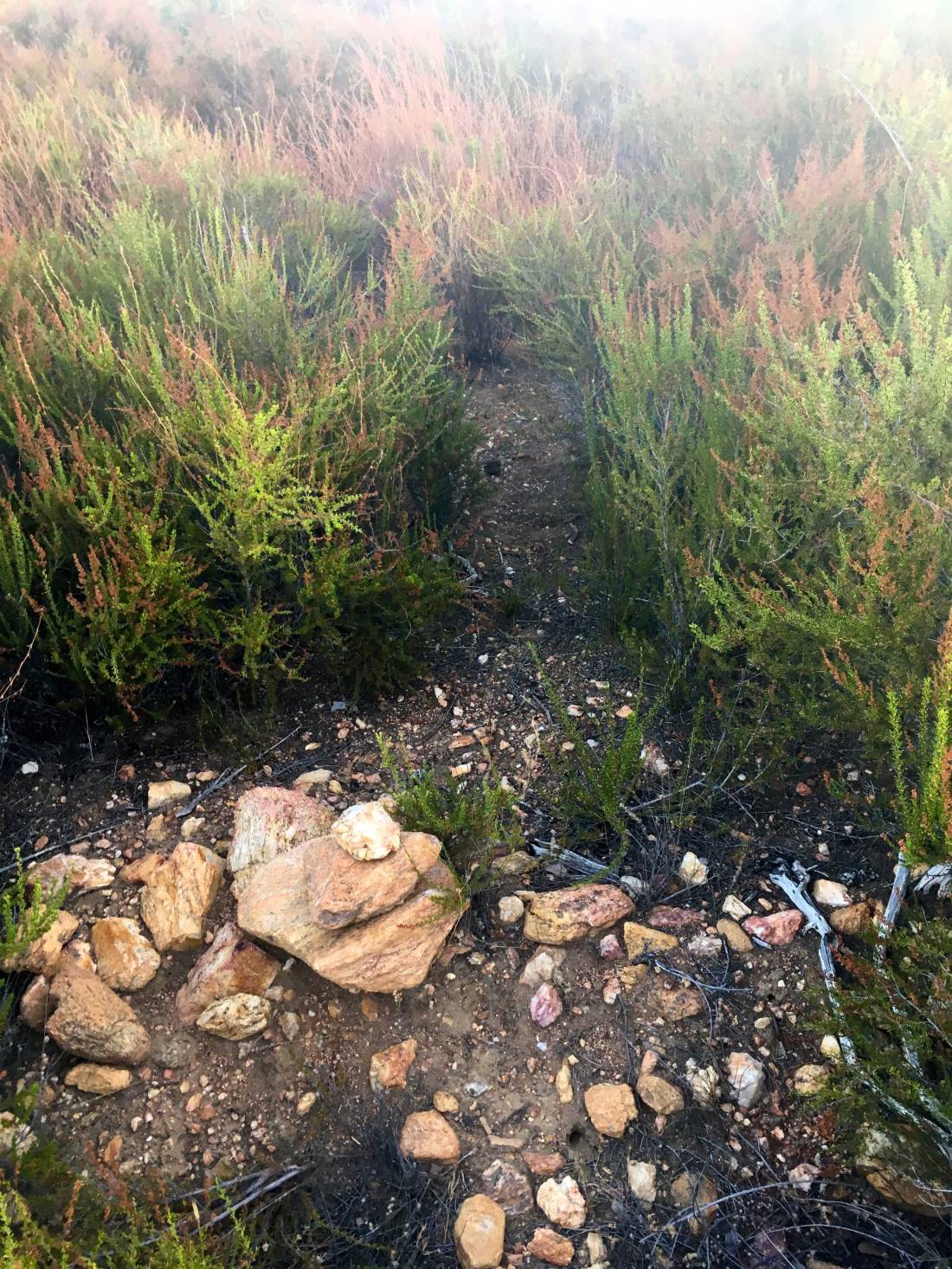
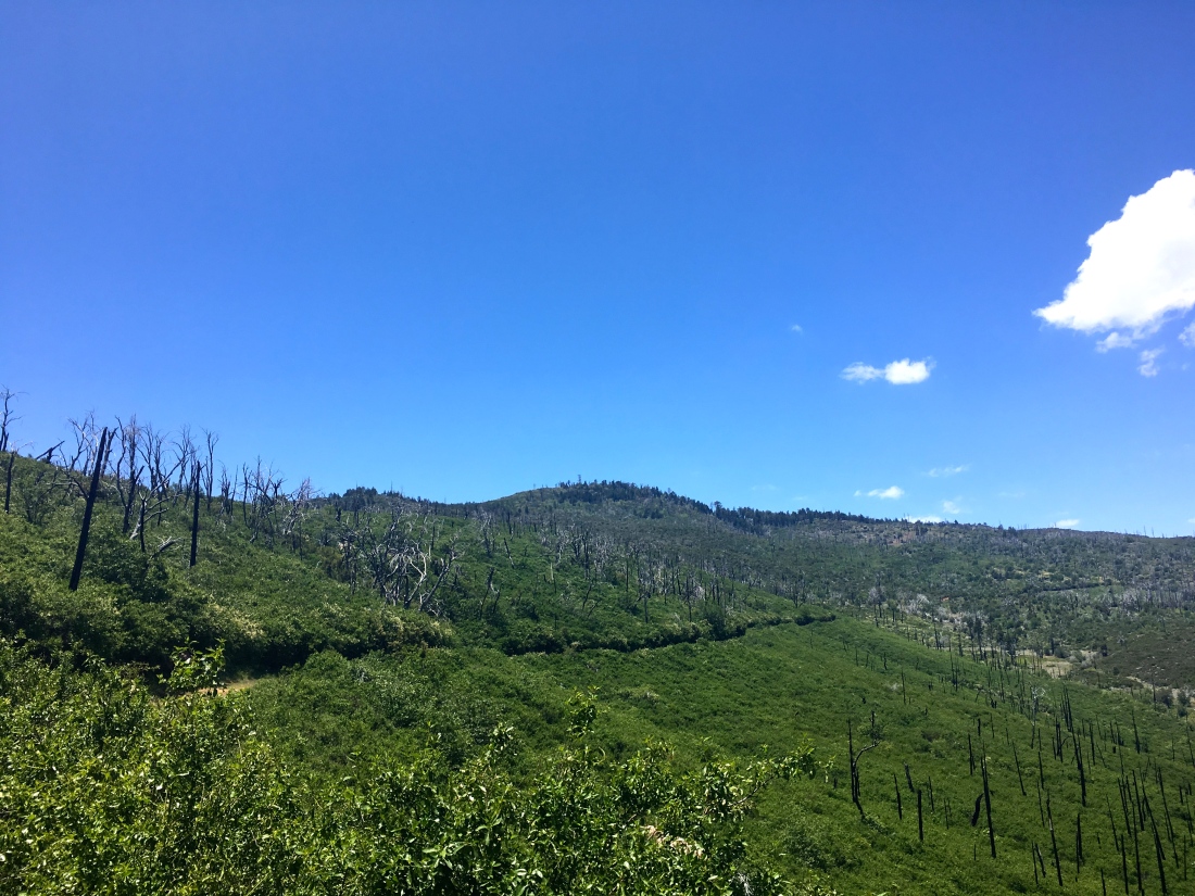
I was making great time along the trail and soon I came to the junction with the spur trail to the actual summit. The trail did become slightly more overgrown in sections. The summit loomed over me, now bathed in the morning light.


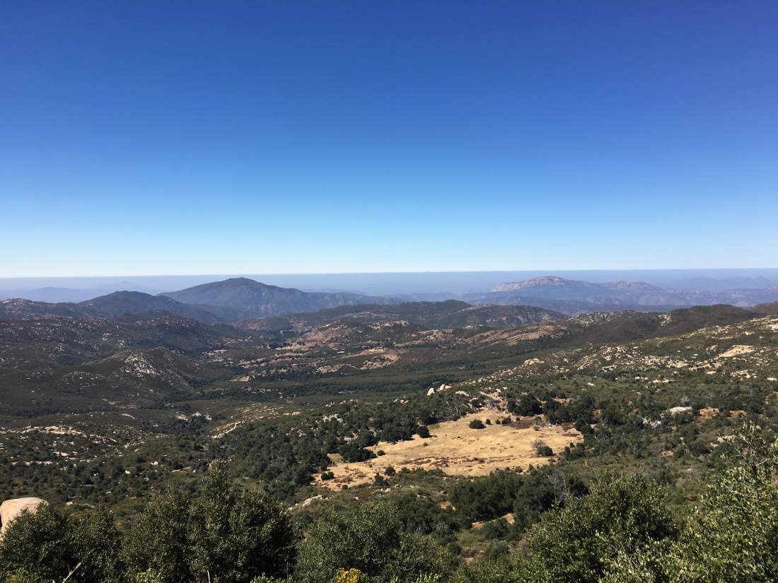
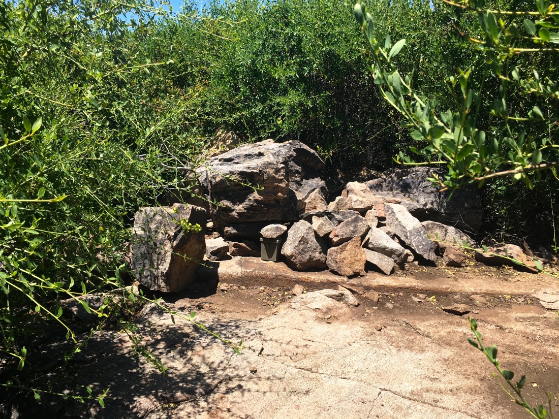
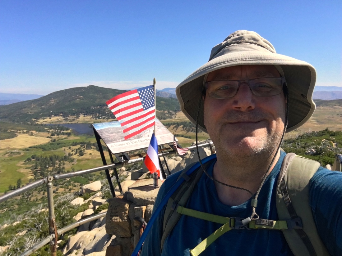
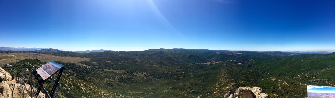
The summit offered some great vistas. Thankfully the bugs were not too bad. This peak does not have a register and a non-standard Benchmark. It also has a rail to tie up your horse.


Coming back down I was passed by a gaggle of trail runners. Three hikers passed me making their ascent. Back at the car, the thermometer read 80 degrees at just after 9 am. This was my 61st peak of my 100 Peak Challenge!

oakziita

Sunshine Mountain

Peak Name: Sunshine Mountain
Distance: 2.62 miles
Date: November 5, 2017 (Sept 7, 2019)
Summit: 3,160 feet

For my Sunday peak, I decided on summiting Sunshine Mountain on an overcast day. My friend Mark Better was able to tag along for this adventure. The trailhead is near the new shared Three Sisters/Eagle Peak one, instead, you continue down the dirt road to the north of that entrance. There you will find a small turn out to park at.

You will follow the trail past a seasonal pond, the drift toward the east. The summit is clearly in view. This is not a well-traveled trail, so it is very overgrown. You will reach a fork in the trail, take the left one. It is almost completely hidden. You can faintly see the outline of tire tracks from years ago to guide you to the base of the peak.

imagejpeg_0

Once at the base of Sunshine Mountain, you will need to bushwhack your way toward the southeastern shoulder of the mountain and begin an easy scramble to the summit.

The sun would peek out from behind the cloud, offering some nice contrast to the peaks around us. We signed the register and enjoyed the views. To the south, we could see Eagle Peak, perched on the edge of the San Diego River Valley, which I had done just a week before.  Off to the east, Cuyamaca Peak was shrouded in clouds the whole day.

As we made our way down, we hunted for that faint trail again.

imagejpeg_3
Hunting for that trail…

We could see the car parked off the distance and did consider just bushwhacking directly back to it. But we a little more sleuthing, we found the trail and made our return trip less eventful.

Update: August 24, 2019

I set off down the closed road to the trailhead for peak #2. This was going to add about .5 miles each way. The road seemed fine. When I reached the trailhead, I headed down a very overgrown road. I was glad to have hiked it before and had my route loaded for reference.

IMG_5275

Passing by the pond, doves flew out from the brush as I walked by. My energy levels were a bit low, but I decided to push on a bit. As the trail began to climb, I just did not have it in me. So I decided to turn back. The mountain will be there another day.

Partway back, I stopped in the shade and cooled off some. As I returned to the car, I saw a family getting ready to head down to Three Sisters. I cautioned them, about the difficulty and the effects of the heat. I got back into the car, and it read 90° F! That was unexpected, I knew that was the forecast, but at 9:30! No wonder I ran out of gas. I called it a day and headed home.

Update: Sept 7, 2019

I initially did not think I was going to get any peaks this weekend, as my son is about to head to Israel for 10 months on the Nativ College Leadership Program. But, I was able to squeeze in two peaks in the early morning.

IMG_5469

Decided to knock out Sunshine Mountain and Ant Benchmark. I had hoped to do them when I did Eagle Peak, but the heat said no! I reached the trailhead for Three Sisters just before sunrise. To my delight, the Cedar Creek Road was open! Woot!! That meant one less mile of hiking! Pulling into the turnout, two cars were parked. I guess it is hunting season… I quietly got ready and headed out.

IMG_5473

The trail is overgrown, like many of the more obscure ones. I reached the base of the mountain just after it became illuminated by the rising sun. I saw a set of cairns, checking my previous track, I set off up the mountain.

IMG_5472

I picked my way through the brush, I lost the cairns for a while, and just relied on my guesses through the brush and rocks. Once I picked the cairns back up the route became easier.

At the summit and took in the view. Eagle Peak was to the southwest of me. There is no benchmark, but I signed the register again. The forecast was that it was going to reach the upper 80s, so I did not want to goof off too long at the summit.

IMG_5477

I made my way down with any issues, I found the main trail again without issue. This was the one hiccup we had when I first did the peak. Quickly I was back at the car and off to my next peak. That was peak #59 of my #100PeakChallenge!

sunshine.jpg


Three Peaks

I wanted to do something with some miles in preparation for the rescheduled Climb For Heroes, looking at my list of remaining hikes for the 100 Peak Challenge Reboot and thought about connecting several of the peaks in the Cuyamacas. The recent rains had extended the wildflowers, so it seemed like a perfect plan. The goal was to summit Airplane Ridge, then up to Japacha Peak, then Cuyamaca, and hit Arrowmaker Ridge on the return. All told about 14 miles of hiking was planned for the day.

I wanted to start this attempt from the Green Valley Campground, but it is currently closed. Instead, I started at the Sweetwater Parking area. Crossing over the flowing water, I began working my way along the Monument Trail toward the first peak of the day, Airplane Ridge. The grade of the trail made the ascent very pleasant. The big peaks loomed ahead of me. So much so, I missed hopping of trail to summit Airplane Ridge. Doh! So I backtracked and tried approaching it from the north. I got close, but not directly at the high point. The bush was too thick. If had done some recon with some satellite imagery, I should have continued backtracking further and would have a clear path, like a remembered from the first ascent from the south. Looking back at my pictures, I even took a photo of where I should have gone.

After hopping back the trail, I began climbing my way up toward Japacha peak. The flowers along the meadow were stunning. Soon I found myself weaving my way through the remaining pine trees on the mountain. The crunch of the needles under my boots was music to my ears.

When I ‘summited’ Japacha Peak the first time I only got partially there, as my hiking partner was in shorts and had to turn back. Not a problem this time, as I scouted a sort of path through the brush to the peak. While there is no benchmark, there is a register. The June Gloom was in full force, but it made for a dramatic scene to the west.

After signing in, and a short rest, I picked my way back through the brush and back on the trail. Cuyamaca towered over me as a continued climbing. The Burnt Pine trail ends at the main road to the summit of Cuyamaca. This was going to be my least favorite portion of this loop, as it is mostly steep and paved.

IMG_3461

I finally encountered my first other hikers of the day along the road. At the summit, I rested and gazed out across the cloud tops covering much of my view. I had the summit all to myself.

I began to work my way down the road to the Fern Fire Road. I began to encounter more hikers making their way to the summit, along with their dogs in tow. I had forgotten how steep the road, as such, my pace slowed some. It might also have been the fact I already hiked 8 miles. I began to become concerned about the time, as I needed to be back in town to celebrate a good friend’s 50th birthday. I wondered if I should just head to the road and hitchhike back to the car.  In the end, I figured I could make it back to the car without too much delay.

IMG_3500
Looking back at Cuyamaca Peak from the Fern Fire Road.

The road gently worked its way down, crossing various springs along the way.  Soon I found myself at the base of Arrowmaker Ridge. I was uncertain if I should attempt it. I was going to be cutting it close in time. Although the peak is not that high, it does require some bushwhacking. Since I was fighting the clock, I had not been resting nearly as much as I normally do. I crossed over the meadow to see if an easy route. Alas, nothing appeared, and I was running out of gas and still had a couple of miles still to go. Since both Middle Peak and Stonewall Peak are nearby, I knew I would have an easy opportunity to try again.

IMG_3505
Arrowmaker Ridge

My route took me along Japacha creek. The flowing water was soothing, I wish I had time to dip my feet into the cool waters and rest.

I finally found myself back at my car with plenty of time to make it to the party. All told this hike covered 14.4 miles in 7 hrs and minutes. The total elevation gain was 2,775 feet. All in all a fantastic day on the trails. That makes 33 summits of the 100 this year.

cuyamaca

Sugg Peak

Peak Name: Sugg Peak
Distance: 7.44 miles
Date: January 20, 2019
Summit: 5,229 feet

Headed out the morning to attempt Sugg Peak again. This time I had Susie Kara to show me the route. We got to the trailhead and one car was already there and the sun was just about to rise above Oakzantia Peak.

img_1620

We made our way along the East Mesa Fire Road, we pass a gentleman heading down, I assume it was his car. Near the junction of the Oakzantia trail, we headed across the meadow toward West Sugg.

There was no trail, just two hikers following their guts. We picked our way through the brush until a slight trail was reveal. Susie kept her eye open for the boundary fences, as these were reference points.

img_1633We came to the old Jeep trail that leads back to Oakzantia, but it was severely overgrown. Given the shape of the stuff we were traversing, it might get tougher soon to summit Sugg Peak.

img_1644

We found Susie’s magic rock and scrambled up. At this point, we were closing in on the summit. We picked our way through the brush until the summit revealed its rocky top.

img_1631

We signed the register, we were the first in 2019! The views of the Cuyamacas and the Lagunas were refreshing. The wind made it a tad chilly, so we did not linger too long.

Sugg Summit

From the summit, I could see the route Mark and I tried. This route was 10x easier. We picked our way down, occasionally correcting our route.

img_1651

Soon we were back at the East Mesa Fire Road and began trekking back the car. Did pass two other hikers and several mountain bikers. Oh, I forgot to add Susie did Baden-Powell yesterday. This was much earlier than my previous attempt.

This was my 85th summit and the final push is now underway!

sugg

Airplane Ridge

Peak Name: Airplane Ridge
Distance: 6.3 miles (including Arrowmaker Ridge)
Date: October 1, 2017 (June 1, 2019)
Summit: 5,000 feet

My final peak for the day was Airplane Ridge, further along, the West Mesa trail. The trail worked its southward. Cuyamaca Peak loomed over me to the west. The trail was mostly empty as the peaceful quiet surrounded me. I crossed the dry Japacha creek and began to slowly gain some elevation. As I neared the sharp right to begin the climb toward Airplane Ridge, I made the short detour to see the monument for which the ridge is named.

On December 7, 1922, a twin-seat model biplane carrying Col. F.C. Marshall and Lt. C.L. Webber crashed into a ridge near Cuyamaca Peak. Despite extensive searches, the wreckage and pilots’ remains weren’t discovered until May the following year.

IMG_5078

After pausing for a bit, I continued on as the day was getting warmer and still had the summit and return trek to the car. I worked my way up the ridgeline until I found a reasonable spot to leave the trail and reach the high point itself.

IMG_5081
The view to the south

I rested under the shade of a tree, enjoying the sweeping views to the south. With my third peak bagged, I begin the 3 miles back to my car. Toward the end of the hike, my IBT began to tighten, making it a bit uncomfortable.

UPDATE – June 1, 2019

Summited this peak again as part of a 14+ mile loop through the Cuyamacas. The full trip report can be found here.

Arrowmaker Ridge

Peak Name: Middle Peak
Distance: 1.9 miles
Date: October 01, 2017 (June 29, 2019)
Summit: 4,740 feet

Update: Have been informed that this peak is now off-limits. It lies within the Pilcha (West Mesa) Cultural Preserve, and since there is no trail it should not be accessed. The replacement peak is now Paradise Mountain.

From the West Mesa parking turnout, I crossed the highway and passed through a gate onto the West Mesa Fire Road. After about a half-mile along the fire road, I reached the junction with the Fern Flat Fire Road. I knew from researching the route to this summit, that I wanted to continue south through a meadow and approach it from the south side. The growth appeared to be thinner based on the satellite imagery I reviewed.

IMG_5071
At the summit

This strategy proved to be correct, as I found the high point. I took my summit-selfie and headed back down and on to the fire road to bag the three summit of the day, Airplane Ridge.

Update – June 29, 2019

After completing my last hike for the 2019 Coast to Crest Challenge earlier in the day, I decided to squeeze in summiting Arrowmaker Ridge. I had hoped to do it when I did my Cuyamaca loop, but time was running short and I had a 50th birthday to get to.

After refueling at Wynola Pizza, I drove down to the West Mesa trailhead and headed out. The trail initially follows the Japacha Fire Road and goes steady upward. At the intersection with the West Mesa Fire Loop Road, it was time to leave the trail and head cross country.

IMG_4060.jpg
Looking back down the road with Stonewall Peak in the distance

I had generated a route from Google Earth to guide me once I left the fire road. Rather than a direct approach to the summit, I crossed the meadow then kept to the southeast side of the ridge which had far less vegetation according to the satellite imagery.

For the most part, this route worked great. The summit is anti-climatic, there is no register nor Benchmark. But if you are working on this challenge, this summit is a perfect one to test out your cross-country navigation skills.

I found my way back down, with a few false starts, I crossed back through the meadow. Unfortunately, my boots and socks were covered in cattails. I picked out the worst of them, but really wished I wore my gaiters.

IMG_4089.jpg

I hustled my way back to the car, as I realized I forgot to hang up my Adventure Pass. Thankful, no nasty gram was on windshield. I shed my boots and socks and drove home. This was peak #43!

Middle Peak

Peak Name: Middle Peak
Distance: 5.8 miles
Date: October 01, 2017 (July 5, 2019)
Summit: 5,883 feet

This was the first of a three-peak day. I arrived at the trailhead just as the sun was beginning to rise.

As I followed the fire road up toward the peak, I spotted several deer enjoying some meadow grasses.

IMG_5041

Once covered in pine and oak trees, Middle Peak, like the rest of Cuyamaca Rancho State Park, was hit hard by the 2003 Cedar Fire. As the summit loomed, the lack of trees did offer some sweeping views. With the trees gone, much of the mountain is now covered in ceanothus, and the charred remains of blackened trees line the slopes. Near the summit, I began looking for any routes through the thickets to the true summit. I worked my way partially toward the summit but eventually decided to call it.

IMG_5065

In part, I knew there was no view to be had, and I had two more summits planned for the day and began back down the fire road to the car.

Update: July 5, 2019

Having summited Stonewall peak earlier one the day, I set out for Middle Peak. The trailhead is 5 minutes north of Stonewall Peak, so it was a perfect choice as a two-fer.

IMG_4230.jpg
Stonewall Peak in the distance

As I parked, quite a few horse trailers were parked nearby. I reapplied my sunscreen and headed along the Milk Ranch road until the turnoff to Middle Peak. For most of the ascent, it follows a slightly rocky fire road, but you are rewarded with great views of Stonewall Peak, Cuyamaca Peak and so much more.

Near the summit, I began looking for the cairn that denotes the start of the use trail to the actual summit. My first attempt was only partially successful, as I only made it partway through the brush.

IMG_4250

This time the trail was better marked, as I picked my way through the brush.  I did encounter a beehive along the route but was able to bypass it without issue. The trail at times was hard to see, so a little faith was needed. It was an adventure to the summit, but soon the summit revealed itself. A register was tucked under some rocks. I signed in, took my photos and enjoyed a snack.

IMG_4258
The summit!

IMG_4271

I was worried about finding the route back down but had no trouble. I even found those bees again 😉

A light breeze helped cool me off as I descended. A slight bruise on my foot was bothering me some. I will have to see how it feels tomorrow and what I attempt. I did encounter one other hiker just as I was nearing the junction.

It felt good to have done two modest peaks in a day. This was my 47th summit and having actually reached it this time made it extra rewarding.

middle_peak


Cuyamaca Peak

Peak Name: Cuyamaca Peak
Distance: 8 miles
Date: July 16, 2017 (June 1, 2019)
Summit: 6,512 feet

The distinctive shape of the Cuyamaca is hard to miss from San Diego looking eastwards toward the mountains. Cuyamaca is the second highest peak in San Diego County and is one is easily summited.

My good friend James decided to tag along for this adventure. Although the temperatures were pleasant, the lack of trees from the Cedar fire, over a decade ago, do make this hike a bit toasty.

IMG_4169

The trail basically follows the service road to the summit. Starting from the Paso Picacho Campground (fee), the paved road works its way steadily toward the summit.  You do pass through one small remaining section of pines as you approach the summit. It is interesting seeing how the forest is slowly recovering from the fire.

Once at the summit, you are rewarded with some of the best views in all of San Diego. On a good clear day, you can see for about 100 miles. For me also being a NASA geek, finding the NASA Goddard marker was cool.

After a snack and long rest, we head down from the summit and over to Japacha Peak, which lies just south of Cuyamaca.

UPDATE – June 1, 2019

Summited this peak again as part of a 14+ mile loop through the Cuyamacas. The full trip report can be found here.

cuyamaca

Stonewall Peak

Peak Name: Stonewall Peak
Distance: 3.8 miles
Date: April 17, 2007 (July 5, 2019)
Summit: 5,730 feet

Some of the peaks on the 100 Peak Challenge, I had done in the past. Given my late start on the challenge, I opted to skip summits that I had already done and move on to new peaks. Stonewall Peak appears to be one of the first summits I did in San Diego. I hiked this peak solo, the day before I turned 39.

Update: July 5, 2019

Since I had the day off, I thought I would head out to the Cuyamaca State Park and try to summit two peaks, the first peak of the day was Stonewall Peak. I parked in the day use lot, after paying my $10 fee and headed across the 79 and began working my way up. 

I started with Stonewall first since I knew I would have some shade for a nice portion of the ascent. The trail worked its way back and forward toward the summit. This is a popular peak, so I also wanted to try to avoid the crowds as well.

The summit’s final section came into view, reminding me of Moro Rock in Sequoia. I had the granite summit to myself for a bit and soaked in the sweeping views. I picked out the various peaks that I have summited.

IMG_4200

Soon I was joined by three other hikers. We chatted a bit and then left them to enjoy the summit by themselves.

IMG_4207

IMG_4204
Cuyamaca, Middle and North Peaks
IMG_4203
Looking out to the east

As I quickly descended, I encountered more and more hikers making their way to the summit.

IMG_4221
Stonewall Peak

Back at the car I had a quick snack and got ready to hike up Middle Peak. This was was the 46th peak on my 100 Peak Challenge!

stonewall