Mother Miguel Mountain

Peak Name: Mother Miguel Mountain
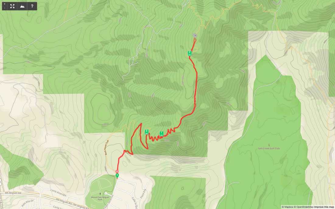
Distance: 3.75 miles
Date: June 17, 2017 (November 9, 2019)
Summit: 1,520 feet

With the temperatures predicted to high everywhere except near the coast, I decided this was the perfect time to drive down and summit Mother Miguel. The ascent began under a blanket of fog. It was thick enough that I had to assist a runner coming down the trail with some directions.

IMG_3863

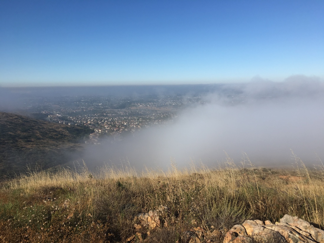
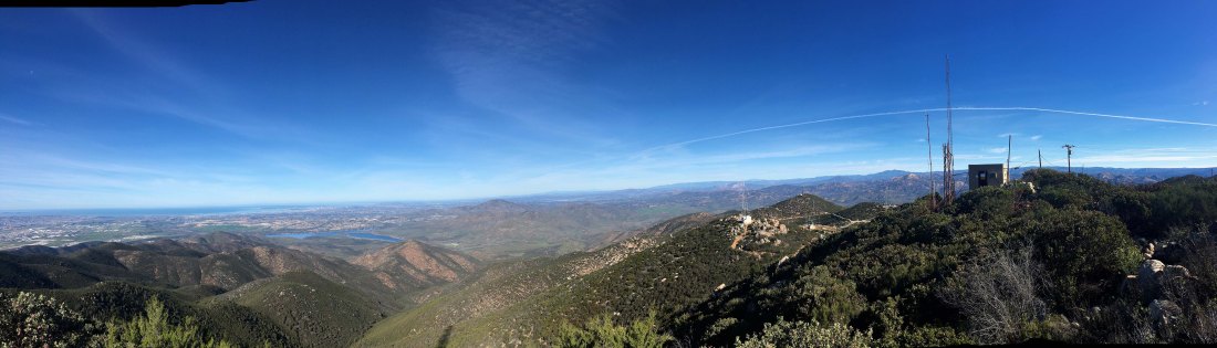
The trail quickly snakes its way up the mountain, and soon the fog burned off revealing a lovely view of the South Bay,

IMG_3872

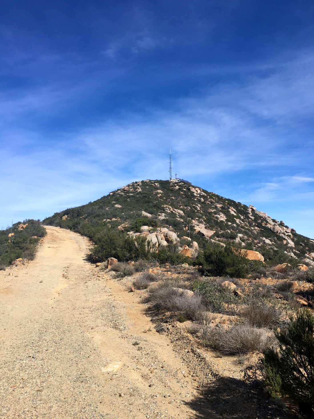
Once the switchbacks end, the trail turns northward toward the summit. The summit is adorned with a POW/MIA flag in addition to the Stars and Stripes. The return down the mountain was uneventful.

Updated: November 9, 2019

Since I had some personal commitments in the morning, a full day of hiking was not in the cards. But  I still had a couple of hikes that I had classified as “in-town”. Ted Markus was free and we thought a sunset from atop Mother Miguel would be a perfect choice. We first stopped by A16 to collect our completion rewards for doing the 3-Peak Challenge. Continuing down to Chula Vista, we found parking right next to the trailhead. It was unseasonably warm, so we were both in shorts and short-sleeves as we headed onto the trail.


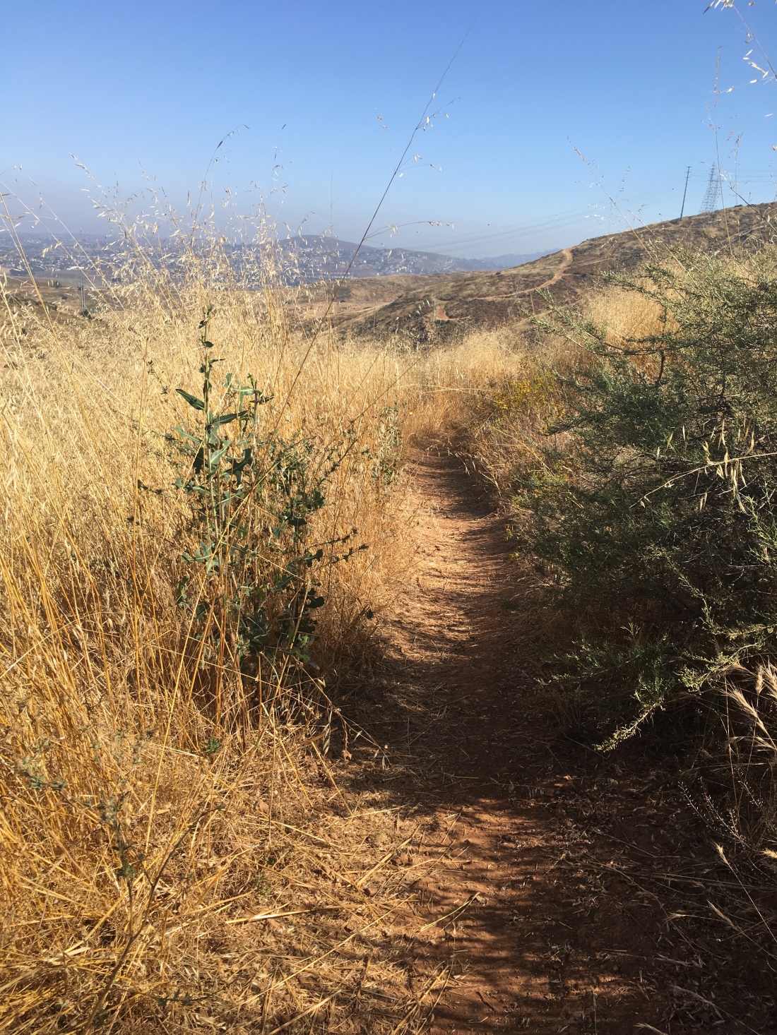
Recently the trail underwent some realignment and I was curious to see the changes. The trail now follows a more switchback route rather than the brutal old direct route. The barbed wire serves as a barrier against using the old trail. The trail is in great shape. So much nicer than Cowles.


We reached the summit with about 30 minutes to kill before the actual sunset. The nearly full moon had risen to the east, and a stream of planes made their approach to the airport passed overhead.

IMG_6815

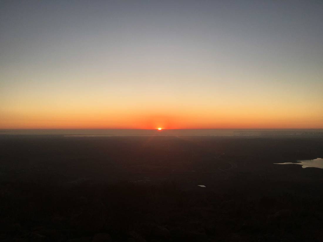
Soon, the sun’s final glow was fading and it was time to begin our descent. Ted was enjoying using the camera on his iPhone 11 to capture the fading glow. Soon we found ourselves back at the car, and peak #80 was now in the bag!

mother_miguel


Tecate Peak

Peak Name: Tecate Peak
Distance: 10 miles
Date: January 27, 2019
Summit: 3,885 feet

The road to Tecate Peak starts a mere 1500 feet from the border. The road follows the wall for a bit before beginning its steep ascent to the summit.

The road was tougher than the road up to Otay Mountain, so I was glad I spent so much of my youth riding motorcycles along the dirt roads of the Sierras. Along the way, I passed two groups of hikers descending.

img_1686

As I neared the summit, I found a nice spot to park and get some dirt under my feet. The view was equally spectacular. Far to the north, I could spy San G’s snow-capped summit. So many other peaks I have had summited also filled my view.

There isn’t a marker here that I could spot, but there is a metal post in concrete. I headed back down the road, never spotting another car. Looking forward to attempting the Sombreros later this week. If you choose to hike this peak, the round-trip distance is about 10 miles and completely exposed.


Otay Mountain

Peak Name: Otay Mountain
Distance: 1.5 miles (from Doghouse Junction)
Date: January 27, 2019
Summit: 3,566 feet

As the peak count dwindles, I still had Otay Mountain and Tecate Peak to the summit. They are not technically challenging, just follow the road to the summits. Now, mind you these are long roads.

img_1667

So, I figured to shave off some miles by driving part way up. First up was Otay Mountain, I turned on to Otay Truck Trail from the trailer park and began my climb. The Subaru handled the road with no issues. Along the way, I passed only one hiker working their way up. I parked at Doghouse Junction, chatted with the Border Patrol agent who was also parked there. From there I headed up to the summit along the road. The views were spectacular. I picked a great day to go.

Otay Summitimg_1681

I did find one marker but knew that would be it.

img_1675

On the way down had a chance to chat with another agent who was scanning the terrain…

I opted to take the truck trail down toward the gun club, as it was in the direction toward Tecate Peak. Working my way down the mountain, I chatted with three motorcycle riders taking a break. Further down, I passed two other cars beginning their ascent. If you choose to hike this summit I would recommend the route from Modern Hiker, it has a round trip distance of 15 miles.