Goat Peak

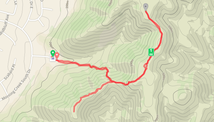
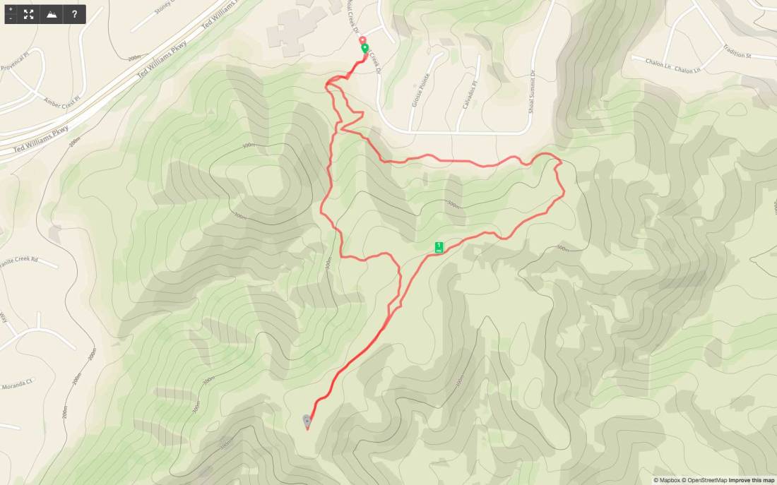
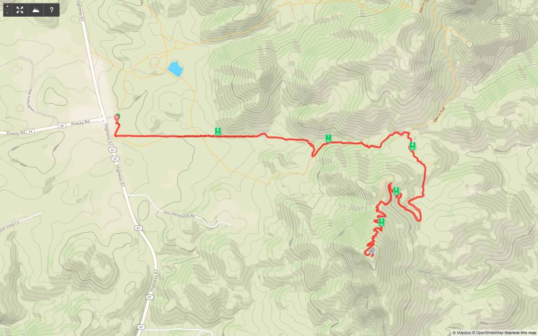
Peak Name: Goat Peak
Distance: 2.75 miles 
Date: October 1, 2019
Summit: 1,724 feet

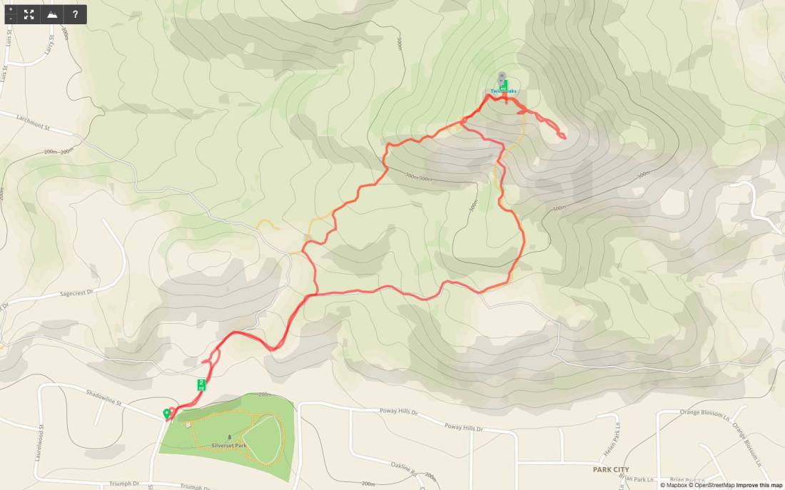
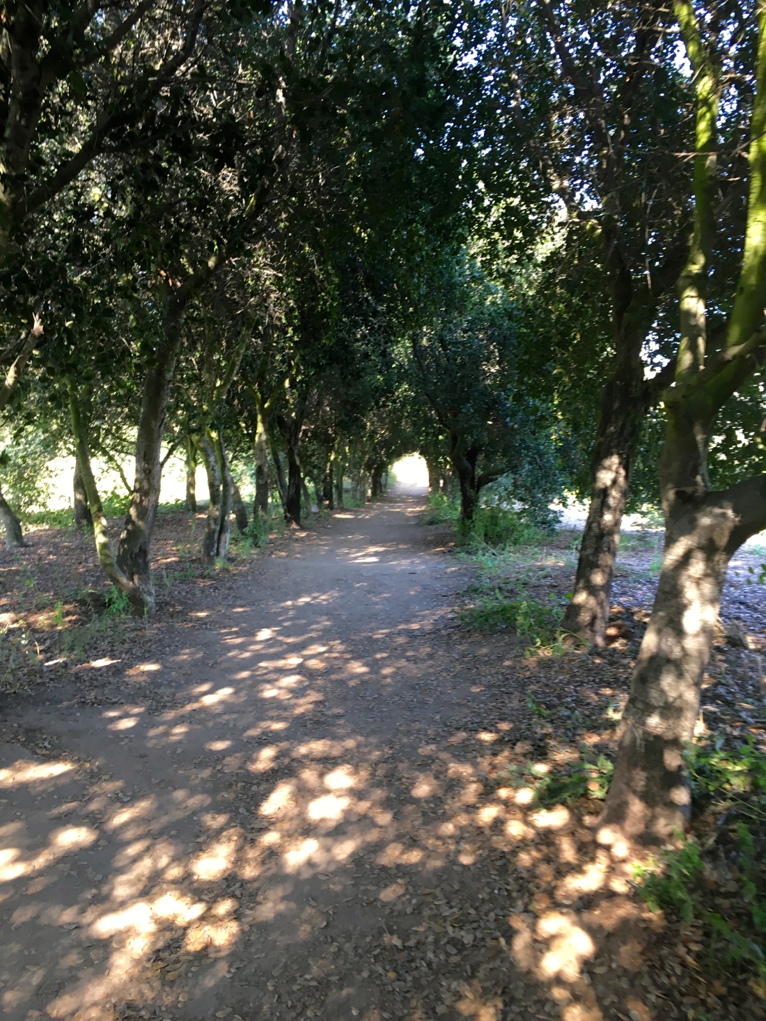
With the trail closed for Rock Mountain, Derek needed to find a replacement peak. After some discussion, Goat Peak in Poway was added to the Challenge. I had some unexpected free time this afternoon, so I decided to go hike it. I had limited research on this peak. I knew where the trailhead was, and a route, but not a lot more than that. The trail begins at the end of Quiet Valley Lane and follows Poway Creek for about 0.7 miles. I crossed the dry creek bed 5 times before leaving the canyon.

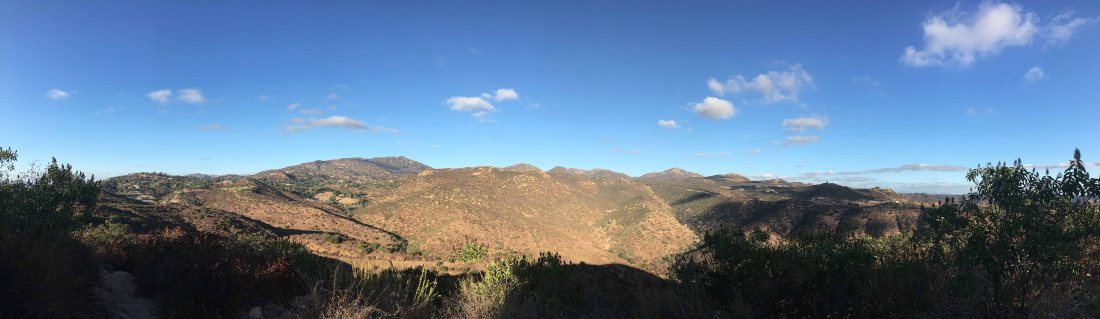
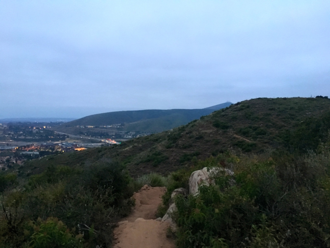
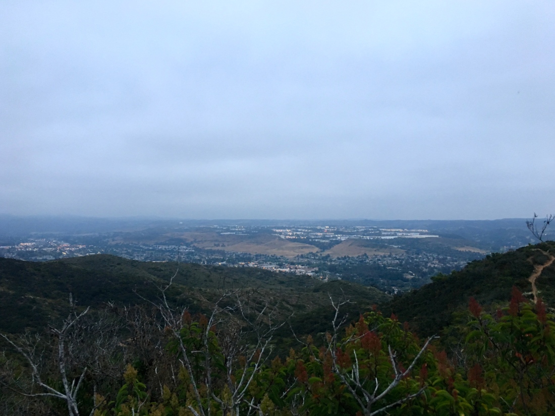
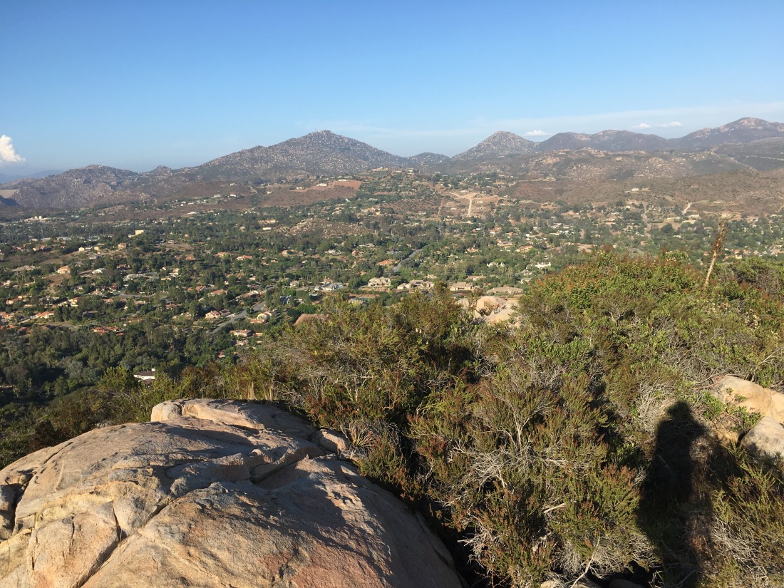
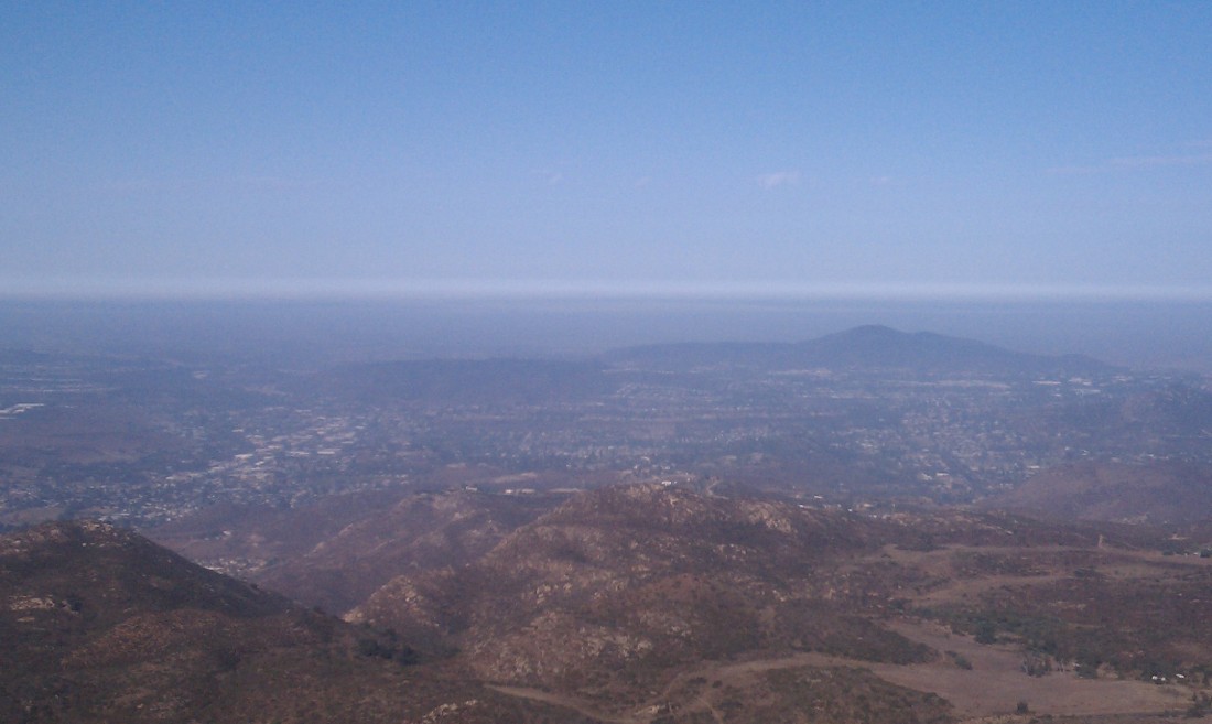
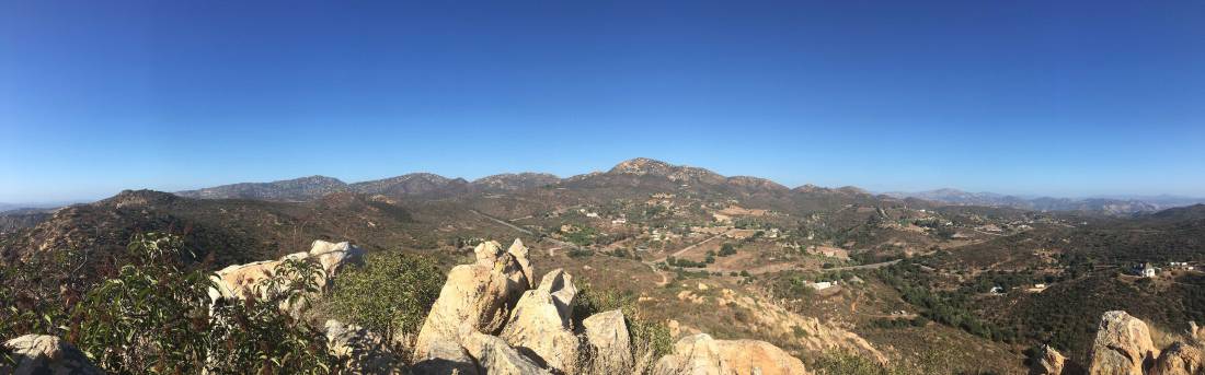
Now the trail changed its character from a gentle stroll to a real workout. Over the next ¼ of a mile, I gained over 400 feet of elevation. The path here is quite eroded and slippery and at times sports ruts down the middle, making footing a bit awkward. Finally, I reached a plateau and found a nice rock to sit on and grab a short breather. It offered a great view back down the canyon. Looking to the east, the actual peak finally came into view.

Soon the trail began working its way up a dry creek where I encountered a few dry waterfalls, some requiring mild scrambling to climb up. So much for doing this hike after some rains… Finally, I left the other creek and the last push to the summit. Throughout the hike, there were portions of the trail built up for mountain bikes, but it was clear they had not been used for some time.

IMG_6144

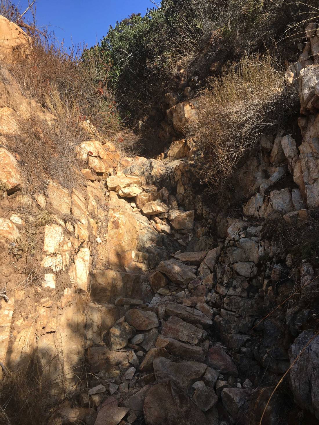
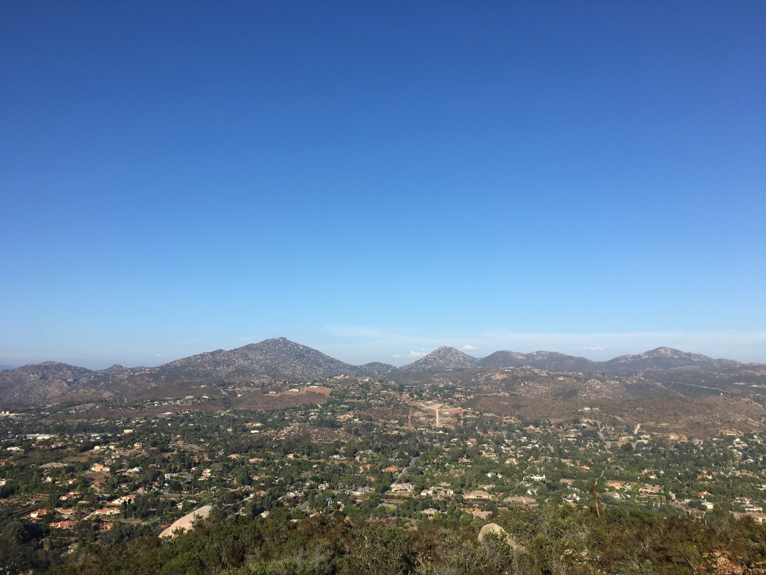
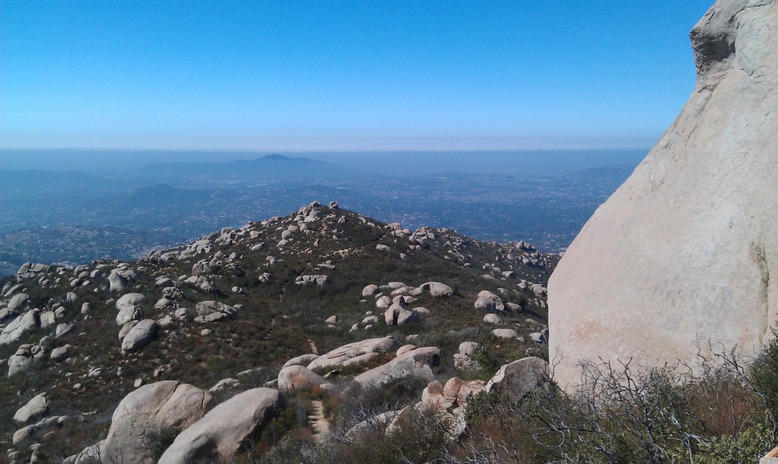
To reach the summit, a little bit of scrambling was required. As I sat and let the breeze cool me off, Mt Woodson stood to the north, and Iron Mountain to the east. I found the register with no problem and added my name.

IMG_6149

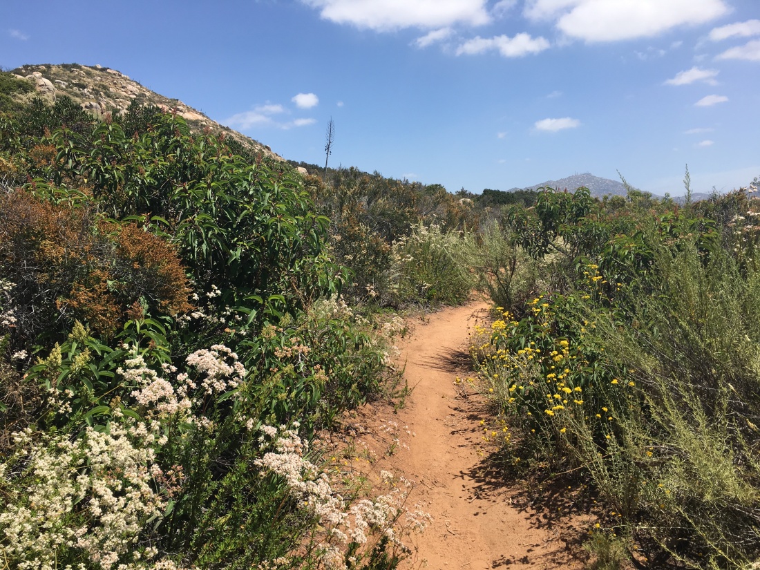
After soaking in the vistas, I carefully worked my way back down the rocks to the main trail. I knew descending was going to be slow, given the trail conditions, but I was in no hurry. While the trail was easy to follow, you are going to need long pants to avoid some of the overgrowth. Soon I had made back down the dry creek and the other steep section. It was nice to get another peak crossed off the list, #71!

goat

Tooth Rock

Peak Name: Tooth Rock
Distance: 2.2 miles
Date: May 28, 2017 (Sept 19, 2019)
Summit: 1,167 feet

As you head east along Poway Road, you might notice a solitary rock perched atop a small hill to the north. This is locally known as Tooth Rock. It is a short hike to the summit. The trailhead is on Range Park Road. I convinced my wife to join me on this adventure. The trail starts off fairly flat before climbing steeply to the summit.

IMG_3729
My wife and I at the summit.

Once at the summit, you are rewarded with a nice view of Poway.

Updated: Septemeber 19, 2019

Since I still had my KT tape on my foot from yesterday’s hike up Mount Israel, I decided to go hike Tooth Rock in Poway.

The trail follows Rattlesnake Creek for about a half mile before starting its steep ascent to the distinctive rock at the summit. The trail is slightly overgrown, but I did not regret wearing shorts.

IMG_5839

The setting sun cast a lovely glow upon Mt. Woodson and Iron Mountain to the east. I took a short breather and headed back down. All told this was 2.2 miles and 525 feet of elevation gain. More importantly my 66th peak of my 100 Peak Challenge!

tooth_rock

Black Mountain

Peak Name: Black Mountain
Distance: 4.1 miles
Date: April 22, 2017 (April 19, 2019)
Summit: 1,554 feet

I can see this peak from my house. I have lost count the number of times I have trekked to the top of this peak. My two standard routes are either via the Nighthawk trail or via Miner’s Ridge. Either route is nice, both eventually intersect the access road to the summit. Miner’s Ridge is along the northeast side of the mountain so you can get some shade if you are hiking in the afternoon. The summit is home to a variety of communication towers, so the view is slightly obstructed. Regardless, it still offers a nice view of Carmel Valley and Del Mar to the west.

Updated: April 19, 2019

When I decided to reboot my 100 Peak Challenge, I figured I should start with the peak in my backyard, Black Mountain. Normally I hike it via the Nighthawk trail, but this time I decided to do via the service road. 

IMG_2646

The road is mostly on the southwest side of the mountain, so I was glad to be doing it early in the morning before the became too warm. Once I reached the summit, Rancho Peñasquitos, Carmel Valley and Del Mar lay before me. 

I snapped a few photos and headed back down. Now to work out the details of this reboot. Now that I have a lot more knowledge about almost all of the hikes I need to do again, I am sure I can work out a smarter strategy for hiking them.

black_mountain

Van Dam Peak

Peak Name: Van Dam Peak
Distance: 3.0 miles (1.8 miles)
Date: June 1, 2017 (June 14, 2019)
Summit: 1,113 feet

Another short hike that is perfect for an after-work excursion. This peak sits near the end of the 56 freeway and the 15 in Poway. The trailhead I started from was at the end of a cul-de-sac. Passing through some house, I could imagine the adventures the neighborhood kids would have in this open space (or the mischief ).

img_3748

The trail quickly rises up to the ridgeline. I opted to head north to the principle summit and the graffitied slab. The sounds of the freeway’s afternoon traffic were muted, but still noticeable. That was offset but the crunch of dirt under my hiking boots. After enjoying the view, I headed back toward the car, making a detour to the south summit.

van_dam
Westside Route

Update: June 14, 2019

Since I had to pick up my daughter from her high school grad night party at 5:00 AM, I figured I might as well get a quick hike since I was up. I could not do anything major since we were sending my son off be a counselor at Camp Ramah later in the morning. Van Dam Peak fit the bill perfectly.

IMG_3795

This time I opted to explore it from the east side. I parked across from the elementary school and began heading up the trail. It was clear that this route is heavily used by mountain bikers, as the trail had been customized with jumps and banked turns. I was glad to be doing this in the pre-dawn and not worrying about being taken down by a rider.

The chirping of birds filled the air, along with the cars traveling along the 15. The route to the top was just under .7 miles. The summit is marked by a graffitied concrete slab.

The June Gloom kept the sunrise from being seen. To the northwest was Black Mountain, to the east was Twin Peaks.

After a few quick photos, I headed back down the trail. Instead of returning the same way, I opted to make this trek into a loop. The east side is crisscrossed with trails, again, mostly for mountain bikes, so I had to check the satellite view to make sure I was on the best path down.

IMG_3801

The trail led me down at to gravel road behind some houses. Following it for a bit, an entrance to the street was available. Instead, I took a narrow trail that would lead me back to the car without using the street. This trail was a bit overgrown and offset the mountain bike elements on the other trails.

IMG_3807

This trail rejoined the trail almost where I started. It was nice to have solitude on this hike, it gave me some time to reflect on my twins’ graduation and their new adventures ahead of them. I got in the car and picked up breakfast for my son at iHop and headed home. This was my #40 summit of my 100 Peaks Challenge!

vandampeak
Eastside Route

Twin Peaks

Peak Name: Twin Peaks
Distance: 2.4 miles
Date: May 14, 2017 (August 7, 2019)
Summit: 1,305 feet

This is a great hike to save for the summer for a quick after-work summit. That is what I did. I had done this peak a few years previously after finding it in Afoot and Afield but decided to formally do it again. This peak is just south and east of the Target in Poway, so it was immediately recognizable to me. The trailhead is next to Silverset park.

IMG_3392
The trail after the rains.

The trail works its way up to the summit with no real issues. It is a nice reminder of all the ‘hidden’ hikes and peaks that are tucked away in town.

IMG_3399

From the summit, you have some nice views of Poway and beyond. I opted to continue the loop, and head down the backside of the mountain. This route is a touch steeper and I am glad I had my hiking poles.

twin_peaks
Update: August 7, 2019

The trail was in good shape as it worked its way up the slopes. Once at the summit, a few thunderheads were lingering over the mountains to the east.

IMG_4975

Rather than head down the east side of Twins Peaks, I decided to head over the other peak just to the southeast of the main peak. It is Twin Peaks after all…

IMG_4979

I explored some overlooks around the lower peak before heading back down. Rather than taking the same route as before, I opted to use one of the other routes back to the park. Soon I found myself back on the main trail, and quickly at the car. This was #51 of the reboot.

twinpeaks_2

Woodson Mountain (aka Potato Chip)

Peak Name: Woodson Mountain
Distance: 7.5 miles / 4.1 miles
Date: October 16, 2011 (August 17, 2019)
Summit: 2,896 feet

Commonly known as the Potato Chip, is another very popular hike in San Diego. The number of cars along Highway 67 always amazes me. The improper gear people are wearing even more so. That said, it does afford some nice views of north county.

IMAG0003

Lake Poway

I did this summit back on October 16, 2011, from the Lake Poway side. This route is longer than the route starting on the 67, but not as steep. Unless you are a Poway resident, a small fee is required to park at the lake. Also, if you are wanting to summit before sunrise, this trailhead will not be officially open.

IMAG0015

The trail is fairly straight-forward, fully exposed, so bring your water, hat and apply sunscreen.

IMAG0013

Once at the top you can enjoy the Disneyland-like line to scramble over and stand atop the Potato Chip. I did this hike before the rise of social media, so there were only about 3 other hikers there when I summited. The actual summit is a bit past the Potato Chip near the towers.

IMAG0006

I would recommend tackling this peak during the week to avoid the crowds.

Update: August 17, 2019

Since I had a family obligation in the morning, decided to summit Mt. Woodson to catch the sunset. I had been trying out some new hiking shoes from Oboz and had been experiencing a burning pain in one ankle. Tried two different sizes and no change. So I decided to switch back to my Merrill’s to see if it was truly the shoes or something else. Unfortunately, I took a closer look at them and a Viking funeral might be in order. So I high tailed to REI and bought some replacements. I tossed them on and drove out to the trailhead off the 67.

IMG_5143

I actually have never done Woodson from this side, as I like the trail up from Poway. The route up follows the service road to the summit. It is short but steep. I really wanted to see how the shoes felt, and I hustled up. I happily held about 23-minute mile.

Upon reaching the towers, I went looking for the benchmark. I found the rock, but there was no way I was scrambling up it solo.

The sunset was still about 20 minutes away, so I decided to check out the Potato Chip. There was a small crowd and was able to get my photo on it again. But once the sun started to go down, I got some great photos.

I made my back down the road, passing quite a few folks heading up. Toward the end, I did break out my headlamp. Soon I was back at the car and happy that it appears that it was the shoes. That was peak #56 of my 100 Peak Challenge!

Iron Mountain

Peak Name: Iron Mountain
Distance: 5.8 miles
Date: August 22, 2015 (June 15, 2019)
Summit: 2,696 feet

When I moved to Rancho Penasquitos, my go-to hikes shifted from Mission Trails to the peaks like Black Mountain, Iron Mountain, and Mount Woodsen.

Iron Mountain looms over Poway at the end of Poway Road. This hike has become more popular over the years. Now, as I drive by the trailhead, the parking lot is often full. The hike is a straightforward trail to the summit. This hike does have the honor of the first time I hiked with Scott Turner, the co-author of Afoot and Afield in San Diego.

IMAG0563
Black Mountain is off in the distance.

If you want to avoid some of the crowds, there is an alternate path for part of the summit via the Ellie Lane Trail.

Update: June 15, 2019

Iron Mountain is another peak that I have done multiple times throughout the years. This peak is a great one to do with the full moon, so I looked up the moon’s cycle and marked down the possible dates. I initially figured this might be a July or August hike, but the stars aligned and we were able to do it in June.

IMG_3812

Ted Markus happily tagged along as we set off under the ornate trailhead sign. The trail then passes under a canopy of trees, the only shade you will find on the trail, which is very typical of many of the hikes in San Diego.

IMG_3815

Neither of us was set on racing up the peak, so we just put in cruise mode. The trail goes eastward for a bit before turning southward and beginning to snake its way up to the summit.

We encountered a few hikers along the trail. Much of the hike was spent talking about our recent high school graduates…

There were two hikers at the summit. We took a short break, enjoyed the views. I pointed out Mt. Gower to Ted and the rough route we took.

IMG_3830


Heading back down, the full began to rise over the mountains while the sun began to descend into the marine layer. We encountered an organized hike working their way up to the summit about a third of the way down.

As we reached the flat portion of the hike, we captured the glow of the sunset and turning around the moon just above the summit of Iron Mountain. A perfect ending to the hike.


ironmtn